
Population 243 (2006 census) Postal code 3285 | Postcode(s) 3285 | |
 | ||
Location 334 km (208 mi) SW of Melbourne72 km (45 mi) W of Warrnambool32 km (20 mi) NE of Portland | ||
Tyrendarra /ˈtɪərəndərə/ is a locality in south west Victoria, Australia. The locality is split between the Shire of Glenelg and the Shire of Moyne local government areas, with most being in the former. It is on the Princes Highway, 338 kilometres (210 mi) south west of the state capital, Melbourne. The Tyrendarra township lies within a bend of Darlot Creek, before it enters the Fitzroy River—which also flows through the locality. At the 2006 census, Tyrendarra and the surrounding area had a population of 243.
Contents
Map of Tyrendarra VIC 3285, Australia
The area was settled in the 1870s and a Post Office opened around February 1879 and closed in 2000.
Tyrendarra is well known for the Tyrendarra Pastoral and Agricultural show and the Tyrendarra Rodeo which are held each year at the Tyrendarra sports reserve.
It has a football team playing in the South West District Football League.
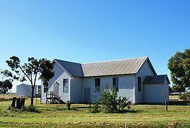
An unusual feature of the village is that it long had two churches and no hotel.
The Budj Bim National Heritage Landscape - Tyrendarra Area on the Australian National Heritage List lies on the Tyrendarra lava flow between the Fitzroy River and Darlot Creek close to the township.