
 | ||
In the Philippines, tropical cyclones (typhoons) are called bagyo. Tropical cyclones entering the Philippine Area of Responsibility are given a local name by the Philippine Atmospheric, Geophysical and Astronomical Services Administration (PAGASA), which also raises public storm signal warnings as deemed necessary. Around 19 tropical cyclones or storms enter the Philippine Area of Responsibility in a typical year and of these usually 6 to 9 make landfall.
Contents
- Etymology and naming conventions
- Names of storms
- Variability in activity
- Tropical Cyclone Warning Signals
- References
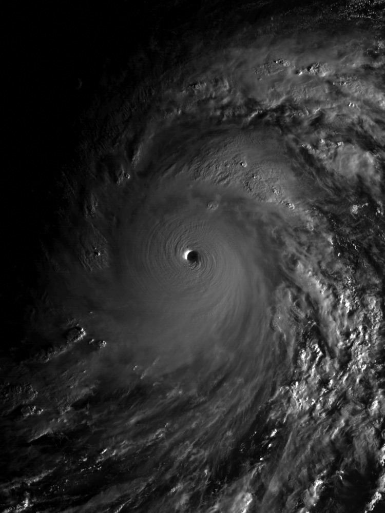
The deadliest overall tropical cyclone to impact the Philippines is believed to have been the Haiphong typhoon which is estimated to have killed up to 20,000 people as it passed over the country in September 1881. In modern meteorological records, the deadliest storm was Typhoon Haiyan/Yolanda, which became the strongest landfalling tropical cyclone ever recorded as it crossed the Central Philippines on November 7–8, 2013. The wettest known tropical cyclone to impact the archipelago was the July 14–18, 1911 cyclone which dropped over 2,210 millimetres (87 in) of rainfall within a 3-day, 15-hour period in Baguio City. Tropical cyclones usually account for at least 30 percent of the annual rainfall in the northern Philippines while being responsible for less than 10 percent of the annual rainfall in the southern islands.
The Philippines is the most-exposed large country in the world to tropical cyclones; the cyclones have even affected settlement patterns in the northern islands: for example, the eastern coast of Luzon is very sparsely populated.
Etymology and naming conventions
It is said that the term bagyo, a Filipino word meaning typhoon arose after a 1911 storm in the city of Baguio had a record rainfall of 46 inches within a 24-hour period.
However, this theory is impossible because the Vocabulario de la Lengua Tagala first published in 1754 contains an entry for "BAG-YO" which translates it as "Tempestad, uracan" (tempest, hurricane), proof that the term "bagyo" already existed in Tagalog in the 1700s. The reverse entry for "Huracan" translates it into Tagalog as "Baguio, Bag-yo".
Names of storms
Since the middle of the 20th Century, American forecasters have named tropical storms after people, originally using only female names. Philippine forecasters from the now-PAGASA started assigning Filipino names to storms in 1963 following the American practice, using names of people in alphabetical order, from A to Z. Beginning in January 2000, the World Meteorological Organization"s Typhoon Committee began assigning names to storms nominated by the 14 Asian countries who are members with each country getting 2 to 3 a year. These names, unlike the American and Filipino traditions, are not names for people exclusively but include flowers, animals, food, etc. and they are not in alphabetical order by name but rather in alphabetical order by the country that nominated the name. After January 2000, Filipino forecasters continued their tradition of naming storms that enter the Philippines Area of Responsibility and so there are often two names for each storm, the PAGASA name and the so-called "international name".
Variability in activity
On an annual time scale, activity reaches a minimum in May, before increasing steadily through June, and spiking from July through September, with August being the most active month for tropical cyclones in the Philippines. Activity falls off significantly in October. The most active season, since 1945, for tropical cyclone strikes on the island archipelago was 1993 when nineteen tropical cyclones moved through the country (though there were 36 storms that were named by PAGASA). There was only one tropical cyclone which moved through the Philippines in 1958. The most frequently impacted areas of the Philippines by tropical cyclones are northern Luzon and eastern Visayas. A ten-year average of satellite determined precipitation showed that at least 30 percent of the annual rainfall in the northern Philippines could be traced to tropical cyclones, while the southern islands receive less than 10 percent of their annual rainfall from tropical cyclones.
Tropical Cyclone Warning Signals
The Philippine Atmospheric, Geophysical and Astronomical Services Administration (PAGASA) releases tropical cyclone warnings in the form of Tropical Cyclone Warning Signals. An area having a storm signal may be under:
These Tropical Cyclone Warning Signals are usually raised when an area (in the Philippines only) is about to be hit by a tropical cyclone. As a tropical cyclone gains strength and/or gets nearer to an area having a storm signal, the warning may be upgraded to a higher one in that particular area (e.g. a signal No. 1 warning for an area may be increased to signal #3). Conversely, as a tropical cyclone weakens and/or gets farther to an area, it may be downgraded to a lower signal or may be lifted (that is, an area will have no storm signal).
Classes for Preschool are canceled when Signal No. 1 is in effect. Elementary and High School classes and below are cancelled under Signal No. 2 and classes for Colleges and Universities and below are cancelled under Signal Nos. 3, 4 and 5.