
Time zone EET (UTC+2) | Elevation 200 m (700 ft) Local time Monday 4:12 PM | |
 | ||
Weather 13°C, Wind NW at 21 km/h, 91% Humidity | ||
Tylisos (Τύλισος, also Pyrgos Tylissos, Tylissos) is a town and a former municipality in the Heraklion regional unit, Crete, Greece. Since the 2011 local government reform it is part of the municipality Malevizi, of which it is a municipal unit. The municipal unit has an area of 131.064 km2 (50.604 sq mi). Population 2,867 in 2011. It is an ancient Minoan peak sanctuary and town. The Municipality of Tylisos was created in 1999 and includes 11 villages. The economy is based on agriculture, mainly grape cultivation (accounting for 4.8% of the island’s production) and olive cultivation. At the same time stock farming of sheep, goats and chickens and beehive farms are abundant.
Contents
Map of Tylissos 715 00, Greece
Archaeology
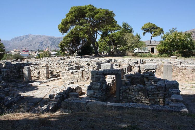
Tylisos was excavated 1909-1913 by Joseph Hadzidakis, 1953-1955 by Nicholas Platon and in 1971 by A. Kanta. The town was in use Early Minoan II to Late Minoan IIIA, and the peak sanctuary,excavated in 1963 by Alexiou was in use until at least Late Minoan IA. Structures include houses, a cistern and an aqueduct with clay pipes. Excavation finds have included a pithos with Linear A inscriptions, stone horns, and clay human and animal figurines.
There are also a significant number of caves including the Kamilari Cave, Hainospilios Cave, Doxsa Cave, Trapeza Cave and Arkalospilios Cave. There are also two gorges which are namely: the Almiros gorge, the Gonies gorge. Agrotourism is also a very popular among visitors all year round. Arolithos village, Ktima Kares and Agrotikon are the most visited sites for this and other leisure activities.
Also nearby is Sklavokampos.