
- location north of Mineral Wells Length 23 km Basin area 132.1 km² | - elevation 923 ft (281 m) - elevation 587 ft (179 m) Basin area 132.1 km² | |
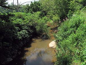 | ||
Tygart Creek is a tributary of the Little Kanawha River, 14.5 miles (23.3 km) long, in western West Virginia in the United States. Via the Little Kanawha and Ohio rivers, it is part of the watershed of the Mississippi River, draining an area of 51 square miles (130 km2) on the unglaciated portion of the Allegheny Plateau.
Map of Tygart Creek, West Virginia, USA
Tygart Creek flows for its entire length in southern Wood County. It rises south of Rockport and flows generally northward through Rockport and Mineral Wells. It flows into the Little Kanawha River from the south, approximately 2 miles (3.2 km) north of Mineral Wells, and approximately 6.7 miles (10.8 km) upstream of the Little Kanawha River's mouth in Parkersburg.
According to the West Virginia Department of Environmental Protection, approximately 71% of the Tygart Creek watershed is forested, mostly deciduous. Approximately 28% is used for pasture and agriculture.