
Type Reservoir Catchment area 25,000 km² (9,600 mi²) Max. length 25 km (16 mi) Surface elevation 328 m Inflow source Big Blue River | Primary inflows Basin countries United States Area 50 km² Outflow location Kansas River Cities Manhattan | |
 | ||
Primary outflows Big Blue River to Kansas River Similar Tuttle Creek State Park, Lovewell State Park, Pomona State Park, Fall River State Park, Konza Prairie | ||
Fishing at tuttle creek lake
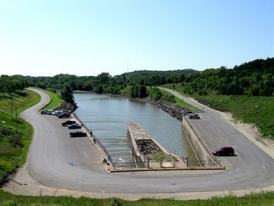
Tuttle Creek Lake is a reservoir on the Big Blue River 5 miles (8 km) north of Manhattan, in the Flint Hills region of northeast Kansas. It was built and is operated by the Army Corps of Engineers for the purpose of flood control.
Contents
- Fishing at tuttle creek lake
- Map of Tuttle Creek Lake Kansas USA
- Tuttle creek lake
- GeographyEdit
- HistoryEdit
- Earthquake threatEdit
- References
Map of Tuttle Creek Lake, Kansas, USA
The lake is bordered by Tuttle Creek State Park, which features 1,200 acres (4.9 km2) of recreational areas, including nature trails, camping sites, and an artificial beach. The state park also hosts the Country Stampede Music Festival every summer.
Tuttle creek lake
GeographyEdit
The border between Riley County (on the west) and Pottawatomie County (on the east) is submerged underneath the lake. The dam is roughly two miles north of Manhattan, Kansas, and is crossed by Kansas Highway 13. Near the river delta at the lakes northern end, a bridge carrying Kansas Highway 16 spans the lake.
HistoryEdit
The construction of Tuttle Creek Dam as a Corps of Engineers project was given impetus by the Great Flood of 1951, which inundated downtown Manhattan. Nevertheless, the project met with heavy opposition from landowners whose land faced flooding. Residents of the Blue Valley organized opposition under the phrase "Let's quit this dam foolishness," and the campaign led to victory for Democrat Howard Shultz Miller in the U.S. House of Representatives in 1952. Although the opposition was heated, it failed to ultimately stop the dam.
When the lake began filling up in 1962, it affected ten towns and entirely submerged four of them (from north to south): Cleburne at 39°31′49″N 96°38′6″W, Randolph, Garrison Cross and Stockdale. The only town to rebuild elsewhere was Randolph, where the streets are named after the submerged towns. The remnants of "Old Randolph", as it's known locally, can still be seen partially submerged to this day.
The value of the dam was proven during the Great Flood of 1993, when floodwaters reaching up to 63 feet (19 m) above normal were held back. However, when the dam reached capacity in July 1993, it necessitated the first release of the spillway. All 18 gates on the spillway were raised 4 feet (1.2 m) during the peak of the flood, producing a flow rate of 60,000 cubic feet per second (1,700 m³/s). The roar of the water was audible half a mile (800 m) away and some people in nearby Manhattan reported hearing the noise. After three weeks the gates were closed, revealing a 20-foot (6.1 m) deep canyon that had been carved in the earth of the spillway channel. The exposed rock is 290 million years old. Locally, this area is known as "The Canyon" and is a popular fossil-hunting area.
Earthquake threatEdit
Although Kansas is not widely known as seismically active, the Humboldt fault line associated with the Nemaha Ridge passes through eastern Kansas, and probably the most active region on the line is in the general vicinity of the lake. Studies that began in the 1980s showed that the geology of the area could potentially produce an earthquake capable of causing the dam to fail, which could risk the lives of thousands downstream in the Blue River and Kansas River valleys.
To address this threat, the Army Corps of Engineers completed a project in July 2010 that reinforced the dam with more than 350 concrete walls to stop channels in the underlying karst, and equipped it with warning sensors.