
Year first lit 1936 Tower shape Square Height 6.1 m Automated 1974 Material Concrete | Foundation Surface Original lens 12 inches (300 mm) Opened 1893 Construction Concrete | |
 | ||
Location Stuart Island, Washington Characteristic White flash every 2.5 s Address Lighthouse Rd, Friday Harbor, WA 98250, USA Similar Patos Island Light, Cattle Point Light, Burrows Island Light, Lime Kiln Light, Dofflemyer Point Light | ||
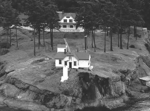
The Turn Point Light is an active aid to navigation overlooking the Haro Straits from the western tip of Stuart Island, San Juan County, off the coast of Washington state in the northwest of the United States.
History
Operations commenced in 1893 with the construction of a fog signal building and a two-story keeper's quarters. The station’s first light was a lens lantern displayed from a post located close to the point. A steam-powered Daboll trumpet served as the fog signal.
In 1936, a square concrete tower was added to the site with a 12-inch (300 mm) light emanating at a 44-foot (13 m) focal plane. A diaphragm foghorn replaced the Daboll trumpet. The station was automated in 1974.
The station is owned by the U.S. Coast Guard and managed by the U.S. Bureau of Land Management. It is part of the San Juan Islands National Monument, which was created in 2013. Volunteers through the Turn Point Lighthouse Preservation Society offer seasonal docent guided tours of the original 1893 Keepers House and a first class exhibit of historic photos.