
Country India District North Sikkim Vehicle registration SK Local time Sunday 4:43 PM | State Sikkim Time zone IST (UTC+5:30) Elevation 1,473 m | |
 | ||
Weather 13°C, Wind S at 6 km/h, 79% Humidity | ||
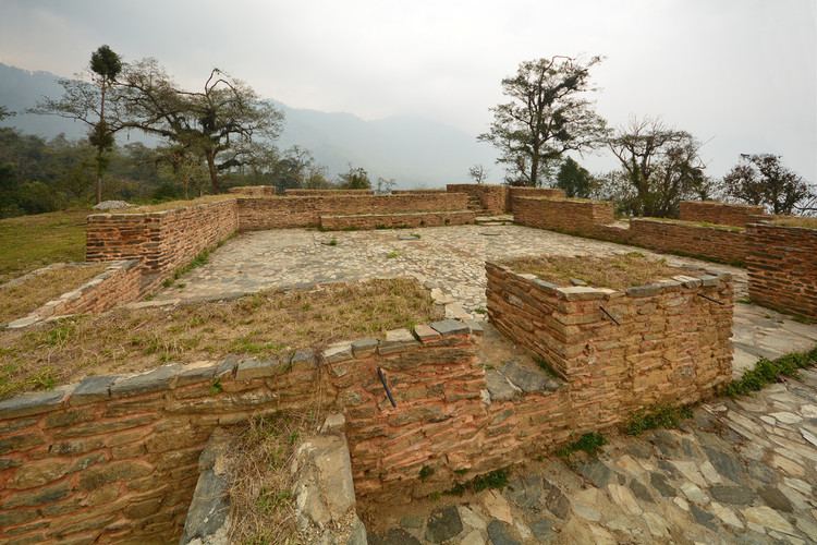
Tumlong is a village in the Indian state of Sikkim. It is located in North Sikkim district and was historically the third royal capital of Sikkim.
Contents
Map of Tumlong, Sikkim 737119
History
In 1894, Thutob Namgyal, the chogyal (monarch) shifted the capital of Sikkim from Tumlong to the current Gangtok. Tumlong was the third capital after Yuksom and Rabdentse close to Nepal. After repeated raids, the capital was shifted to Tumlong, further inland, in 1793 by Tshudpud Namgyal. The Treaty of Tumlong was signed here in 1861 between the British and the Sikkim Rajah.
Geography
Tumlong is located at 27.42°N 88.58°E / 27.42; 88.58. It has an average elevation of 1,473 metres (4,833 feet).
People
Many of the men are monks at the monastery at the top of the village. The villagers speak Buhti, Nepali and Hindi. The population is approximately less than 100.
Education
Tumlong has an elementary school and is a short walk from a high school.
Healthcare
In Tumlong (specifically in Phodong under the same gram panchayat) there is a Primary Health Centre (PHC) with two residential doctors and a staff including nurses.