
Elevation 2,972 m (9,751 ft) World height ranking 2 Longest drop 411 m Phone +27 21 424 1037 | Total height 948 m (3,110 ft) Height 948 m Number of drops 5 | |
 | ||
Similar Amphitheatre, Oloʻupena Falls, Vinnufossen, Yumbilla Falls, Tres Hermanas Falls | ||
Tugela falls drakensberg drone flight
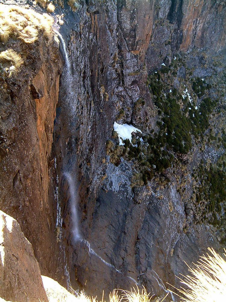
Tugela Falls is a complex of seasonal waterfalls located in the Drakensberg (Dragon's Mountains) of Royal Natal National Park in KwaZulu-Natal Province, Republic of South Africa. It is generally accepted as the world's second-tallest waterfall but there is an argument that it is actually the tallest waterfall in the world, rather than Venezuela's Angel Falls.
Contents
- Tugela falls drakensberg drone flight
- Tugela falls ampitheater drakensberg
- Height controversy
- Access
- References
The combined total drop of its five distinct free-leaping falls is 948 m (3,110 ft). In 2016, however, a Czech scientific expedition took new measuments, making the falls 983 m tall. The data were sent to the World Waterfall Database for confirmation. The source of the Tugela River (Zulu for 'sudden') is the Mont-Aux-Sources plateau which extends several kilometers beyond The Amphitheatre escarpment from which the falls drop.
Tugela falls ampitheater drakensberg
Height controversy
There is an argument that Tugela Falls is the tallest waterfall in the world, rather than the more commonly cited Angel Falls. This argument is based on two likely inaccuracies regarding the presumed heights of the respective falls.
Firstly, many now believe Angel Falls is not as tall as was initially surveyed by American journalist Ruth Robertson in 1949. The quoted figure of 979 m (3,212 ft) corresponds almost precisely with the difference in altitude between the top of the falls and the confluence of the Rio Gauja and the Rio Churun, which is roughly 2 km (1.2 mi) away from the base of the Auyan Tepui escarpment and 1.6 km (0.99 mi) downstream from the last segment of the Rio Gauja that could possibly be considered a ‘waterfall’.
The starting altitude of Angel Falls is often given as 1,500 m (4,900 ft), from which the falls plunge a vertical 807 m (2,648 ft), then proceed to cascade for approximately 0.4 km (0.25 mi) with relatively little altitude loss, before a final drop of 30 m (98 ft) below the Talus Rapids, near the famous viewpoint known as Mirador Laime. After this the Rio Gauja flows with very little altitude loss, with nothing approaching a waterfall or even cascade before it empties into the Rio Churun. However, the altitude of Mirador Laime is usually given as approximately 700 m (2,300 ft), which would suggest that Angel Falls is only about 800 meters in total height (roughly the height of the first drop).
Angel Falls, however, is almost universally regarded as having the tallest single uninterrupted drop of any waterfall in the world (the total height of Tugela Falls, even though possibly the tallest on Earth, is divided into five smaller tiers, and its tallest individual tier is 411 m (1,348 ft)). Even this measurement invites some debate, however, as some botanical sources list the height of Angel Falls' tallest drop as 738 m (2,421 ft), rather than the usually cited 807 m (2,648 ft).
Access
At the right time of year, the falls are easily visible from the main road into the park, especially after a heavy rain. There is an undeveloped camp site and mountain hut immediately above the falls.
There are two trails to Tugela Falls. The most spectacular trail is to the top of Mont-Aux-Sources, which starts at "The Sentinel" car park (through Phuthaditjhaba on the R57, approximately two hours drive from Royal Natal National Park via the R74, 90 minutes from Harrismith via the R712, or 80 minutes from Golden Gate Highlands National Park). From here it is a relatively easy climb to the top of the Amphitheatre, however it does take about 4.5 to 8 hours round-trip depending on fitness level. Access to the summit is via two chain ladders. This is the only day hiking trail which leads to the top of the Drakensberg escarpment. Another trail to the foot of the Tugela Falls starts at Royal Natal National Park. The easy 7 km (4.3 mi) gradient up the Tugela Gorge winds though indigenous forests. The last part of the hike to Tugela Falls is a boulder hop. A little chain ladder leads over the final stretch for a view of the falls rushing down the amphitheater in a series of five cascades.