
Country Japan District Nakauonuma Population 9,851 (Jun 2016) | Prefecture NIigata Phone number 025-765-3111 Local time Sunday 11:49 AM | |
 | ||
Region Chūbu (Kōshin'etsu) (Hokuriku) Time zone Japan Standard Time (UTC+9) Weather 7°C, Wind E at 6 km/h, 56% Humidity Points of interest Mount Naeba, Midamafudoson, Midama Park, Riverside Tsunan, Maekura Bridge | ||
Tsunan (津南町, Tsunan-machi) is a town located in Nakauonuma District, Niigata Prefecture, in the Hokuriku region of Japan. As of 1 June 2016, the town had an estimated population of 9,851 and a population density of 57.9 persons per km². Its total area was 170.21 square kilometres (65.72 sq mi).
Contents
- Map of Tsunan Nakauonuma District Niigata Prefecture Japan
- Geography
- Surrounding municipalities
- History
- Economy
- Education
- Railway
- Highway
- References
Map of Tsunan, Nakauonuma District, Niigata Prefecture, Japan
Geography
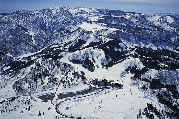
Tsunan is located in southwestern Niigata Prefecture, in a mountainous area bordering northern Nagano Prefecture. Due to its geographical location between the Sea of Japan and the surrounding Japanese Alps it has one of the highest annual snowfalls in Japan. There are numerous ski resorts within the region. Mount Naeba, 2143 meters, is partly located within the town limits.
Surrounding municipalities
History
The area of present-day Tsunan was part of ancient Echigo Province. The modern town of Tsunan was established on January 1, 1955 by the merger of the villages of Tomaru, Kamigo, Ashigasaki, Akinari, Nakafukami and Shimofunato.
Economy
The local economy is dominated by agriculture. The area is known for its rice, sake, tomatoes, sunflowers, and buckwheat noodles.
Education
Tsunan has three public elementary schools and one public middle school. There is one public high school operated by the Niigata Prefecture Board of Education.