
- elevation 1,460 ft (445 m) | - elevation 56 ft (17 m) | |
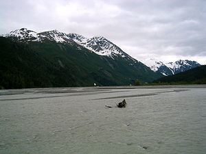 | ||
The Tsirku River is a glacier-fed stream in Southeast Alaska near the town of Haines in the U.S. state of Alaska. The river's source is found at the Tsirku Glacier, a large, sprawling ice mass at the border of Alaska and the Canadian province of British Columbia. The river ends in a 4-mile (6 km) wide delta near the Tlingit village of Klukwan. While many of the feeding glaciers are primarily in British Columbia, the river course lies entirely in Alaska.
Map of Tsirku River, Klukwan, AK, USA
After the Klehini River, the Tsirku River is the second largest tributary of the Chilkat River.
References
Tsirku River Wikipedia(Text) CC BY-SA