
Postal code 7063, 7063 Elevation 1,350 m Local time Sunday 1:25 AM District Plessur Region | Canton Graubünden Area 27.74 km² Population 317 (31 Dec 2008) Sfos number 3932 | |
 | ||
Weather 2°C, Wind SW at 2 km/h, 85% Humidity | ||
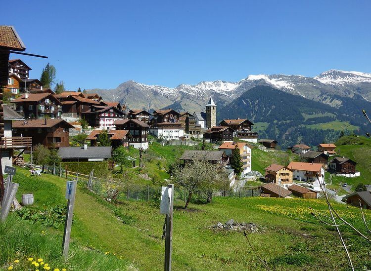
Tschiertschen-Praden is a municipality in the Plessur Region in the Grisons, Switzerland. It was formed on 1 January 2009 through the merger of Praden and Tschiertschen.
Contents
Map of 7064 Tschiertschen-Praden, Switzerland
Geography
Tschiertschen has a combined area, as of 2006, of 27.8 km2 (10.7 sq mi).
Before 2017, the municipality was located in the Churwalden sub-district of the Plessur district on the mountain slopes above the left side of the Schanfigger valley. It consists of the haufendorf village (an irregular, unplanned and quite closely packed village, built around a central square) of Tschiertschen at an elevation of 1,351 m (4,432 ft) and the linear villages of Inner- and Usserpraden at an elevation of 1,100 m (3,600 ft) and 1,250 m (4,100 ft) respectively.
Demographics
Tschiertschen-Praden has a population (as of 31 December 2015) of 314.
The combined historical population is given in the following table:
Weather
Tschiertschen has an average of 123.9 days of rain per year and on average receives 1,095 mm (43.1 in) of precipitation. The wettest month is August during which time Tschiertschen receives an average of 140 mm (5.5 in) of precipitation. During this month there is precipitation for an average of 12.7 days. The month with the most days of precipitation is June, with an average of 13.1, but with only 128 mm (5.0 in) of precipitation. The driest month of the year is February with an average of 61 mm (2.4 in) of precipitation over 12.7 days.