
Area 186.4 km² | Time zone EET (UTC+2) Population 6,314 (Dec 2009) | |
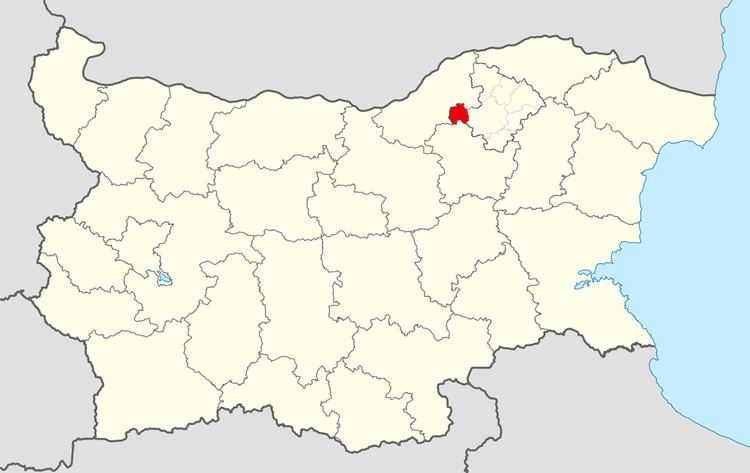 | ||
Tsar Kaloyan Municipality (Bulgarian: Община Цар Калоян, former name Hlebarovo Municipality) is a small municipality (obshtina) in Razgrad Province, Northeastern Bulgaria, located in the Danubian Plain about 27 km southeast of Danube river. It is named after its administrative centre - the town of Tsar Kaloyan.
Contents
Map of Tzar Kaloyan, Bulgaria
The municipality embraces a territory of 186.42 km² with a population of 6,314 inhabitants, as of December 2009.
The main road E70 crosses the area, connecting the province centre of Razgrad with the city of Ruse and respectively the Danube Bridge with the eastern operating part of Hemus motorway.
Settlements
Tsar Kaloyan Municipality includes the following 3 places (towns are shown in bold):
Demography
The following table shows the change of the population during the last four decades.