
- left Tazlău - location Adjud Country Romania Cities Onești, Comănești | - location Ciuc Mountains Length 162 km Mouths Adjud, Siret Villages Comănești, Onești | |
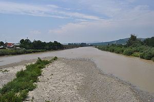 | ||
The Trotuș (Hungarian: Tatros) is a river in eastern Romania, a right tributary of the river Siret. It emerges from the Ciuc Mountains in the Eastern Carpathians and joins the Siret after passing through Comănești and Onești in Bacău County. The total length of the Trotuș from its source to its confluence with the Siret is 162 km (101 mi). Its basin area is 4,456 km2 (1,720 sq mi).
Contents
Map of Trotu%C8%99 River, Romania
Towns and villagesEdit
The following towns and villages are situated along the river Trotuș, from source to mouth: Lunca de Sus, Lunca de Jos, Ghimeș-Făget, Palanca, Agăș, Comănești, Dărmănești, Târgu Ocna, Onești, Adjud.
TributariesEdit
The following rivers are tributaries to the river Trotuș:
Left: Gârbea, Valea Întunecoasă, Antaloc, Valea Rece, Bolovăniș, Tărhăuș, Șanț, Cuchiniș, Brusturoasa, Camenca, Sugura, Dracău, Agăș, Seaca, Ciungi, Asău, Urmeniș, Plopul, Larga, Cucuieți, Vâlcele, Caraclău, Tazlău, Pârâul Mare, Gârbova
Right: Comiat, Bothavaș, Ugra, Boroș, Valea Capelei, Aldămaș, Popoiul, Ciugheș, Cotumba, Grohotiș, Sulța, Ciobănuș, Supan, Uz, Dofteana, Slănic, Nicorești, Oituz, Cașin, Găureana, Gutinaș, Bogdana, Căiuți, Popeni, Bâlca, Domoșița