
 | ||
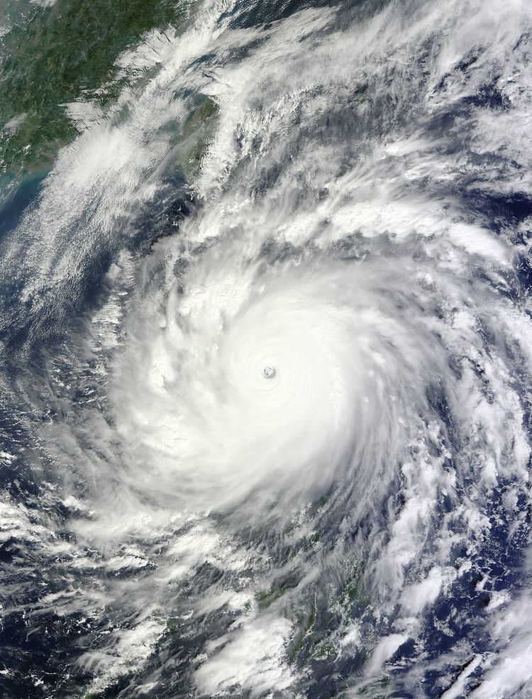
Tropical cyclones of 2010 were spread across seven oceanic basins in their respective seasons; the strongest of these tropical cyclones was Typhoon Megi (2010), which strengthened to a minimum barometric pressure of 885 mbar (hPa; 26.13 inHg) before striking the east coast of Luzon in the Philippines. Regional Specialized Meteorological Centers (RSMC) and Tropical Cyclone Warning Centers (TCWC) designated names to 67 systems worldwide, of which 46 occurred in the northern hemisphere while 21 developed in the southern hemisphere. The most active basin in 2010 was the North Atlantic, which documented 19 named systems, while the North Indian Ocean, despite only amounting to five named systems, was its basin's most active since 1998. Conversely, both the West Pacific typhoon and East Pacific hurricane seasons experienced the least number of cyclones reaching tropical storm intensity in recorded history, numbering 14 and 8, respectively. Activity across the southern hemisphere's three basins—South-West Indian, Australian, and South Pacific—was spread evenly, with each region recording seven named storms apiece. That hemisphere's strongest tropical cyclone was Cyclone Edzani, which bottomed out with a barometric pressure of 910 mbar (hPa; 26.88 inHg) in the South-West Indian Ocean.
Contents
The costliest tropical cyclone in 2010 was Hurricane Karl, which struck the Veracruz, Mexico area in September, causing US$5.6 billion in damage. Hurricane Alex and tropical storms Matthew, and Agatha were the only other tropical cyclones worldwide in 2010 to accrue over US$1 billion in damage. Agatha was also the year's deadliest storm, killing 190 people primarily in Guatemala after lasting for only one day over the waters of the East Pacific.
Tropical cyclone activity monitoring in each basin is officially under the purview of seven RSMCs. Both serving under the United States National Weather Service, the National Hurricane Center (NHC) monitors the North Atlantic and East Pacific, while the Central Pacific Hurricane Center (CPHC) monitors the central Pacific. Pacific typhoons are tracked by the Japan Meteorological Agency (JMA) while cyclones in the North Indian Ocean are tracked by the Indian Meteorological Department (IMD). The Météo-France center in Réunion (MFR) oversees activity in the South-West Indian Ocean. The Australian region is actively observed by five different TCWCs, mostly under the direction of the Australian Bureau of Meteorology (BOM). This is similar to the monitoring of the South Pacific, which is done by both the Fiji Meteorological Service (FMS) and the Meteorological Service of New Zealand Limited. Though not official, agencies such as the Philippine Atmospheric, Geophysical and Astronomical Services Administration (PAGASA) and Joint Typhoon Warning Center (JTWC) provide additional guidance in tropical cyclone tracking.
January and February
The first tropical cyclone worldwide in 2010, Edzani, was first noted as a weak low-pressure area in the area of responsibility of the tropical cyclone warning center in Perth, Western Australia on January 1. After crossing into the South-West Indian Ocean, the system developed into a tropical cyclone early on January 3. Tracking in a general southwest motion, the system reached tropical storm intensity on January 6, peaking with winds of 220 km/h (140 mph) two days later over open waters. Edzani quickly receded into Antarctic latitudes and dissipated on January 15. Two storms in the Australian region, Neville and Magda, were designated as tropical cyclones and named simultaneously on January 20, with the former developing in the Coral Sea and the latter developing near the Timor Sea. Neville only lasted for two days and remained quasi-stationary throughout its lifespan before succumbing to wind shear on January 21. Tracking southward, Cyclone Magda peaked with sustained winds of 130 km/h (80 mph) before making landfall on the coast of Kuri Bay on January 21 at similar intensity; Magda degenerated into a remnant low-pressure system over Western Australia on January 24. Originating from South Pacific and then crossing westward into Australian waters, Cyclone Olga was named on January 23, steadily intensifying before making landfall south of Cairns, Queensland on January 25. After moving inland, a nearby trough steered the system northward and then back eastward into the Gulf of Carpentaria, allowing for Olga to restrengthen before making a final landfall on the Gulf Country coast on January 30; Olga dissipated shortly thereafter.