Country India District Kasaragod Time zone IST (UTC+5:30) Area 27.3 km² Local time Saturday 3:34 AM | State Kerala Talukas Hosdurg PIN 671310 Population 41,201 (2011) ISO 3166 code ISO 3166-2:IN | |
 | ||
Weather 26°C, Wind NE at 3 km/h, 92% Humidity University Govt. Polytechnic, Thrikaripur | ||
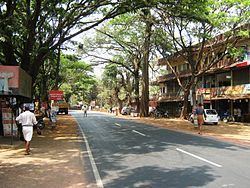
Trikaripur or Elambachi is a village in Kasaragod district of Kerala state in India.
Contents
- Map of Thrikaripur Kerala
- Demographics
- History
- Etymology
- Geography
- Culture
- Tourist Attractions
- Places of worship
- Educational institutions
- Members of the village council
- Transportation
- References
Map of Thrikaripur, Kerala
Demographics
The 2001 Census of India determined that the population of Trikaripur had a population of 32,626.
History
Trikaripur was part of the Mooshika Dynasty in ancient days. During the British Raj Trikarpur was administered under the Madras Presidency in Malabar District. It became part of Kerala with that state's formation on November 1, 1956.
Etymology
Parasurama (one of Lord Vishnu's "avathar") during his journey to Kerala concentrated on the construction of temples. He constructed a city of towers and mansions decorated with gold and precious stones. He made a menagerie for elephants with arrangements for feeding and breeding. This place is known as "The sacred Village of elephant "(Thiru-Karipuram) and later on "Thrikkaripuram" (similar to Thrikkanamathilakam which was originally Thiru-Kana Mathilakam) which with the passage of time came to be known as the present day "Thrikaripur".
Geography
Trikaripur lies along the coast of Arabian Sea, at 12.15°N 75.15°E / 12.15; 75.15 This Panchayat serves as the separating border for Kasaragod District and Kannur District.
Culture
Trikaripur is notable for its folk arts performances, including Kaliyattam (Theyyam) and Kolkali festivals.
Tourist Attractions
Places of worship
Educational institutions
Members of the village council
Transportation
Local roads have access to NH.66 which connects to Mangalore in the north and Calicut in the south. The nearest major railway station is Trikaripur on Mangalore-Palakkad line. There are airports at Mangalore and Calicut.
