
 | ||
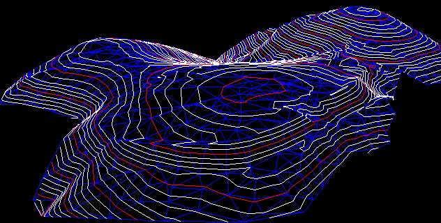
A triangulated irregular network (TIN) is a digital data structure used in a geographic information system (GIS) for the representation of a surface. A TIN is a vector-based representation of the physical land surface or sea bottom, made up of irregularly distributed nodes and lines with three-dimensional coordinates (x, y, and z) that are arranged in a network of nonoverlapping triangles.
A TIN comprises a triangular network of vertices, known as mass points, with associated coordinates in three dimensions connected by edges to form a triangular tessellation. Three-dimensional visualizations are readily created by rendering of the triangular facets. In regions where there is little variation in surface height, the points may be widely spaced whereas in areas of more intense variation in height the point density is increased.
A TIN used to represent terrain is often called a Digital Terrain Model (DTM). An advantage of using a TIN over a rasterized digital elevation model (DEM) in mapping and analysis is that the points of a TIN are distributed variably based on an algorithm that determines which points are most necessary to an accurate representation of the terrain. Data input is therefore flexible and fewer points need to be stored than in a raster DEM, with regularly distributed points. A TIN may be less suited than a raster DEM for certain kinds of GIS applications, such as analysis of a surface's slope and aspect. A DTM can be formed from a DEM. A DEM can be interpolated from a TIN.
A TIN is typically based on a Delaunay triangulation, but its utility will be limited by the selection of input data points: well-chosen points will be located so as to capture significant changes in surface form, such as topographical summits, breaks of slope, ridges, valley floors, pits, and cols.
Although usually associated with three-dimensional data (x, y, and z) and topography, TINs are also useful for the description and analysis of general horizontal (x and y) distributions and relationships.
The first triangulated irregular network program for GIS was written by W. Randolph Franklin, under the direction of David Douglas and Thomas Peucker (Poiker), at Simon Fraser University in 1973.