
Country Vietnam Area 598 km² Province An Giang Province | Capital Tri Tôn Local time Wednesday 12:51 PM | |
 | ||
Time zone Indochina Time (UTC+07:00) Weather 31°C, Wind E at 18 km/h, 68% Humidity Points of interest Núi Cô Tô, Núi Tượng, Suối Vàng, Công Viên Trung Tâ | ||
Khu di t ch i t c d p an t c tri t n an giang tuc dup hill an giang province vietnam
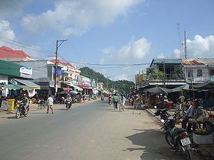
Tri Tôn is a rural district (huyện) of An Giang Province in the Mekong Delta region of Vietnam. As of 2003 the district had a population of 118,648. The district covers an area of 598 km². The district capital lies at Tri Tôn and is 44 kilometres away from Châu Đốc. There is a sacred mountain system named Seven Mountains here where Bửu Sơn Kỳ Hương's monks live.
Contents
- Khu di t ch i t c d p an t c tri t n an giang tuc dup hill an giang province vietnam
- Map of Tri TC3B4n An Giang Province Vietnam
- Administrative divisions
- References
Map of Tri T%C3%B4n, An Giang Province, Vietnam
It is the largest and most sparsely populated of the districts in An Giang, being quite mountainous.
It was the location of the Ba Chúc massacre committed by the Khmer Rouge in 1978, which was part of a series of cross-border incursions that prompted a Vietnamese invasion of Cambodia.
Administrative divisions
The district is divided into two townships, Tri Tôn (district capital) and Ba Chúc and the communes of Châu Lăng, Lương Phi, Vĩnh Phước, Lương An Trà, Lạc Quới, Vĩnh Gia, Núi Tô, An Tức, Ô Lâm, Cô Tô, Tà Đảnh, Tân Tuyến.