
OS grid reference SJ268425 Post town LLANGOLLEN Sovereign state United Kingdom | Country Wales Postcode district LL20 Local time Wednesday 6:27 AM | |
 | ||
Weather 6°C, Wind W at 14 km/h, 80% Humidity | ||
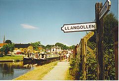
Trevor (Welsh: Trefor) is a village in the county borough of Wrexham (until 1974 in Denbighshire) in Wales. It is situated in the scenic Vale of Llangollen, on the A539 between Llangollen and Wrexham in the community of Llangollen Rural.
Map of Trevor, Llangollen, UK
Its name is an anglicised version of the Welsh place-name Trefor, meaning "large village". This was one of the old townships of the parish of Llangollen, giving its name to both a powerful landowning family whose ancestral home was in the township, and to the later industrial settlement represented by the modern village. In common with neighbouring Froncysyllte, Trevor is largely made up of nineteenth- and twentieth-century cottages for workers in the area's traditional industries of limestone quarrying and brick-making. Although these industries have now disappeared the area has a rich industrial archeology.
Trevor lies on the Llangollen Canal at the northern end of the Pontcysyllte Aqueduct; the Trevor Basin is at the north end of the aqueduct. Until 1965 the village once had a railway station on the now long closed/disused Ruabon to Barmouth line,
However the nearby Heritage Llangollen Railway aims (once work on the extension to Corwen is completed) to extend eastwards to Ruabon passing the village of Trevor itself (whom may include rebuilding and full restoration of the old train station itself as part of the extension).
The Offa's Dyke Path passes through the village.