
Founded June 15, 1968 Time zone PST (UTC+8) Mayor Johnmark C. Billanes | Barangays Area 555.7 km² Local time Wednesday 11:50 AM | |
 | ||
Weather 27°C, Wind NE at 13 km/h, 91% Humidity | ||
Rocksteddy trento agusan del sur
Trento, officially the Municipality of Trento (Cebuano: Lungsod sa Trento; Filipino: Bayan ng Trento), is a municipality in the province of Agusan del Sur in the Caraga (Region XIII) of the Philippines. The population was 51,565 at the 2015 census. In the 2016 electoral roll, it had 30,392 registered voters.
Contents
- Rocksteddy trento agusan del sur
- Map of Trento Agusan del Sur Philippines
- Geography
- Climate
- Barangays
- Demographics
- Economy
- References
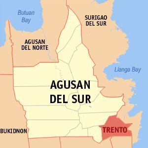
Map of Trento, Agusan del Sur, Philippines
Trento was formerly a barrio of Bunawan called Bahayan (referring to a lead sinker at the base of a fishing net). On June 15, 1968, it became a separate municipality through Republic Act No. 5283. The town’s name was derived from the Council of Trent.
Geography
Trento is located at 8°03′N 126°04′E.
According to the Philippine Statistics Authority, the municipality has a land area of 555.7 square kilometres (214.6 sq mi) constituting 5.56% of the 9,989.52-square-kilometre- (3,856.98 sq mi) total area of Agusan del Sur.
Climate
Trento is classified as Type II climate which has no dry season but with pronounced maximum rain period occurring from December to January.
Barangays
Trento is politically subdivided into 16 barangays.
Demographics
In the 2015 census, Trento had a population of 51,565. The population density was 93 inhabitants per square kilometre (240/sq mi).
In the 2016 electoral roll, it had 30,392 registered voters.
Economy
Its economy is dependent heavily on subsistence agriculture, wood products, and some mining.