
 | ||
9 8 14 1 tremont street boston common boston ma
Tremont Street is a major thoroughfare in Boston, Massachusetts.
Contents
- 9 8 14 1 tremont street boston common boston ma
- Map of Tremont St Boston MA USA
- Video of 151 tremont street 22e boston massachusetts real estate homes
- Etymology
- Points of interest
- Transportation
- References
Map of Tremont St, Boston, MA, USA
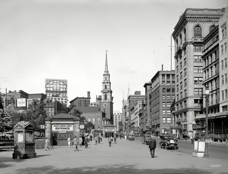
Tremont Street begins at Government Center in Boston's city center as a continuation of Cambridge Street, and forms the eastern edge of Boston Common. Continuing in a roughly southwesterly direction, it passes through Boston's Theater District, crosses the Massachusetts Turnpike, and becomes a broad boulevard in the South End neighborhood. It then turns to the west as a narrower four-lane street, running through Mission Hill and terminating at Brigham Circle, where it intersects Huntington Avenue. The street name zigzags across several physical roads, often requiring a sharp turn to remain on the street.
Video of 151 tremont street 22e boston massachusetts real estate homes
Etymology
The name is a variation of one of the original appellations of the city, "Trimountaine", a reference to a hill that formerly had three peaks. Beacon Hill, with its single peak, is all that remains of the Trimountain. Much of the Trimountain was removed, and the earth used as fill to expand the Shawmut Peninsula. The two smaller peaks, Cotton Hill (or Pemberton Hill, at what is now Pemberton Square) and Mt. Whoredom (or Mt. Vernon, formerly at the location of the modern-day Louisburg Square) no longer exist. The central peak, Sentry Hill, now called Beacon Hill, is smaller than the original peak, which reached approximately to the height of the top of the State House.
A British military map of Boston from 1775, prepared by a Lieut. Sir Thomas Hyde Page of His Majesty's Corps of Engineers, shows Beacon Hill, Mount Whoredom, and another unnamed hill all just above Beacon Street. There is a small street on the northeast corner of Boston Common called "Treamount Street" from School Street to Hanover Street, the precursor of modern Tremont Street, running north from what was then called Common Street (modern Tremont Street alongside the eastern border of Boston Common).
Points of interest
Sites of interest along Tremont Street, from northeast to southwest, include:
Transportation
The Tremont Street Subway runs underneath the street. Opened in 1897, it was the first subway tunnel in North America and still carries the MBTA Green Line.
The Green Line stops in three places under Tremont Street: