
Country United States Area code(s) 864 Elevation 334 m Population 4,843 (2013) | State South Carolina Time zone Eastern (EST) (UTC-5) FIPS code 45-72430 Zip code 29690 Local time Tuesday 4:24 PM | |
 | ||
Weather 27°C, Wind SW at 24 km/h, 35% Humidity | ||
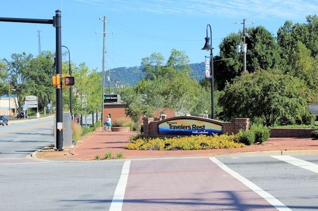
Travelers rest south carolina
Travelers Rest is a city in Greenville County, South Carolina, United States. The population was 4,576 at the 2010 census, up from 4,099 at the 2000 census. The population was an estimated 4,994 in 2015. It is part of the Greenville–Mauldin–Easley Metropolitan Statistical Area. Travelers Rest is located between the Blue Ridge Mountains and Greenville, the primary city of the Upstate region of South Carolina. The campus of Furman University is located just south of the city limits of Travelers Rest, but the university retains a Greenville address based on its ZIP code. The name "Travelers Rest" came from the fact that it is situated close to the border with the North Carolina mountains. Travelers would stop for a moment in the town before they began the difficult journey into the mountains. Travelers would often have to spend the winter there, waiting for the snow to clear in the mountains before continuing northward.
Contents
- Travelers rest south carolina
- Map of Travelers Rest SC USA
- Travelers rest south carolina branding
- History
- Geography
- Demographics
- Downtown revitalization
- Education
- References
Map of Travelers Rest, SC, USA
Travelers rest south carolina branding
History
The John H. Goodwin House and George Salmon House are listed on the National Register of Historic Places. A marker has been placed at the site of the home of Dicey Langston, regarded as a "heroine in the American Revolution", home on Tigerville Road.
Geography
Travelers Rest is located north of the center of Greenville County at 34°58′12″N 82°26′16″W (34.970100, -82.437814). U.S. Route 276 passes through the center of town as Main Street, leading northwest 25 miles (40 km) to the North Carolina border at the crest of the Blue Ridge Mountains north of Caesars Head and south 9 miles (14 km) to the center of Greenville. U.S. Route 25 passes through the east side of the city, leading north 30 miles (48 km) to Hendersonville, North Carolina, and south 12 miles (19 km) to Interstate 185 to the west of Greenville.
As of the 2010 census, the city had a total area of 4.6 square miles (11.8 km2), of which 0.02 square miles (0.06 km2), or 0.54%, were water.
Demographics
As of the census of 2000, there were 4,099 people, 1,563 households, and 1,137 families residing in the city. The population density was 930.8 people per square mile (359.7/km²). There were 1,729 housing units at an average density of 392.6 per square mile (151.7/km²). The racial makeup of the city was 77.36% White, 18.30% African American, 0.27% Native American, 1.22% Asian, 1.68% from other races, and 1.17% from two or more races. 4.22% of the population were of Hispanic or Latino ethnicity.
There were 1,563 households out of which 38.0% had children under the age of 18 living with them, 49.6% were married couples living together, 18.6% had a female householder with no husband present, and 27.2% were non-families. 22.5% of all households were made up of individuals and 8.8% had someone living alone who was 65 years of age or older. The average household size was 2.60 and the average family size was 3.04.
In the city, the population was spread out with 29.9% under the age of 18, 9.6% from 18 to 24, 29.4% from 25 to 44, 20.3% from 45 to 64, and 10.7% who were 65 years of age or older. The median age was 32 years. For every 100 females there were 93.1 males. For every 100 females age 18 and over, there were 86.7 males.
The median income for a household in the city was $34,917, and the median income for a family was $38,229. Males had a median income of $30,377 versus $22,634 for females. The per capita income for the city was $15,704. About 12.2% of families and 15.8% of the population were below the poverty line, including 23.9% of those under age 18 and 11.8% of those age 65 or over.
Downtown revitalization
Adopted by City Council in November 2006, the "Downtown Revitalization" plan was started to create "elements" in Travelers Rest such as:
Education
Furman University was incorporated into the city of Travelers Rest on April 18, 2013. The city is the home of the Travelers Rest High School Devildogs.