
Number of airports 1 | Time zone ICT (UTC+7) Local time Tuesday 6:16 PM Amphoe Trang Province | |
 | ||
Weather 28°C, Wind NE at 18 km/h, 73% Humidity Neighborhoods Mu Ban Nuan Trang, Mu Ban Chai Mongkhon | ||
7 must go places in trang thailand
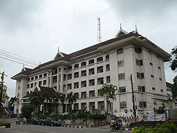
Trang (Thai: ตรัง, [traŋ], also Mueang Thap Thiang เมืองทับเที่ยง) is the capital of Trang Province, Thailand. The city (thesaban nakhon) has a population of 59,637 (2005) and covers the whole tambon Thap Thiang of Mueang Trang district. Trang is 839 km south of Bangkok.
Contents
- 7 must go places in trang thailand
- Map of Trang Mueang Trang District Trang Thailand
- 3 must go islands in trang thailand
- Geography
- Climate
- Transportation
- References
Map of Trang, Mueang Trang District, Trang, Thailand
3 must go islands in trang thailand
Geography
Trang lies on the Trang River, roughly halfway between the Tenasserim Hills and the coast of the Andaman Sea.
Climate
Trang has a tropical monsoon climate (Köppen climate classification Am). At just 8°N, the temperature in Trang is sees little variation throughout the year, although the pre-monsoon months from February to April are a little hotter in the daytime. The year is divided into a short dry season, from January to March, and a long wet season from April to December, with the heaviest rain in September. There is still some rain, however, in the dry season.
Transportation
The main road through Trang is Phetkasem Road (Route 4), which connects the city to Phatthalung and the border with Malaysia to the south-east, and to Krabi, Phang Nga, Phuket (via Route 402), Ranong, Chumphon, Prachuap Khiri Khan, Phetchaburi, Ratchaburi, and Bangkok to the north.
Trang is on a branch (terminating at Kantang of the Southern Line of the State Railway of Thailand.
Trang is served by Trang Airport, seven km from the city. Thailand AirAsia and Nok Air provide service to Bangkok from Trang.