
Country Vietnam Time zone UTC + 7 (UTC+7) Province Khanh Hoa Province | Region South Central Coast Area 496 km² Area code 58 | |
 | ||
Tin vui vi t nam m r ng s n bay tr ng sa 127
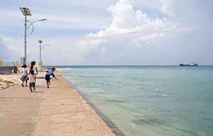
Trường Sa is an island district of Khánh Hòa Province in the South Central Coast region of Vietnam. It was established on the basis of the Spratly Islands, which is also claimed wholly or in part by the Republic of China (Taiwan), the People's Republic of China, the Philippines, Malaysia and Brunei. According to the 2009 census, the district has a population of 195 people.
Contents
- Tin vui vi t nam m r ng s n bay tr ng sa 127
- y ho ng sa kia tr ng sa
- Geography
- Administrative history in the 20th century
- Administration
- References
y ho ng sa kia tr ng sa
Geography
Trường Sa District was established on the basis of small coral islands/cays, reefs and banks of the Spratly Islands which is 248 nautical miles away from Cam Ranh. As the islands contains a large number of scattered geographic entities, it is imaginatively divided into eight clusters including Song Tu, Thi Tu, Loai Ta, Nam Yet, Sinh Ton, Trường Sa, Tham Hiem and Binh Nguyen by Vietnam.
Administrative history in the 20th century
Administration
According to Decree No. 65/2007/NĐ-CP of 11 April 2007 issued by the Government of the Socialist Republic of Vietnam, Trường Sa District has three administrative units including one commune-level town (Trường Sa) and two rural communes (Song Tử Tây and Sinh Tồn).
- Trường Sa Town was established on the basis of Trường Sa Island (Spratly Island) and surrounding islands, reefs and banks.
- Song Tử Tây Commune was established on the basis of Song Tử Tây island (Southwest Cay) and surrounding islands, reefs and banks.
- Sinh Tồn Commune was established on the basis of Sinh Tồn Island (Sin Cowe Island) and surrounding islands, reefs and banks.
In reality, Trường Sa District is effectively administering only 21 islets and reefs of the Spratly Islands: