
Population 4,741 (Nov 2015) | - Tree Cryptomeria japonica Area 261.3 km² Local time Tuesday 11:51 AM | |
 | ||
Weather 9°C, Wind W at 18 km/h, 59% Humidity Points of interest Kusanagi Hot Spring, Shiraito Falls, Togawa Shrine | ||
Tozawa (戸沢村, Tozawa-mura) is a village located in Mogami District, Yamagata Prefecture, in the Tohoku region of northern Japan.
Contents
- Map of Tozawa Mogami District Yamagata Prefecture Japan
- Geography
- Neighboring municipalities
- History
- Economy
- Education
- Railways
- Highways
- Local attractions
- Sister city relations
- References
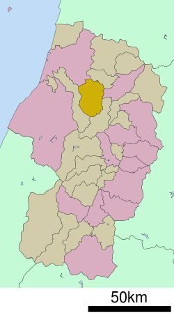
Map of Tozawa, Mogami District, Yamagata Prefecture, Japan
As of October 2015, the village had an estimated population of 4,749 and a population density of 18.2 persons per km². The total area was 261.31 square kilometres (101 sq mi).
Geography
Tozawa is located in north-central eastern Yamagata Prefecture, bordered to the east by the Dewa Mountains. The Mogami River runs through the village.
Neighboring municipalities
History
The area of present-day was Tozawa part of ancient Dewa Province and during the Nara Period and early Heian period was an important fortified point on the road connecting Akita Castle on the Sea of Japan with Tagajo on the Pacific Ocean. During the Sengoku period, the area was under the control of the Mogami clan. During the Edo period, the village was a river port on the Mogami River. After the start of the Meiji period, the area became part of Mogami District, Yamagata Prefecture. The modern village of Tozawa was established on April 1, 1889. It absorbed the neighboring villages of Furukuchi and Kadokawa in 1955.
Economy
The main industry is agriculture, livestock and forestry.
Education
Tozawa has three elementary schools, one middle school and one combined elementary/middle school.