
Country Japan - Tree Cryptomeria Area 155.9 km² Local time Tuesday 10:40 AM | District Kitashitara - Flower Narcissus Population 1,144 (May 2015) Prefecture Aichi Prefecture | |
 | ||
Region Chūbu region
Tōkai region Time zone Japan Standard Time (UTC+9) Weather 11°C, Wind S at 6 km/h, 46% Humidity Points of interest Hagitaroyama, Chausuyamakogenno Museum, Shintoyone Dam, Yunoshima Hot Spring, Chausuyamakogen Ski Area | ||
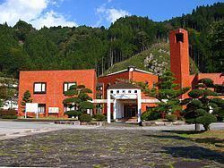
Toyone (豊根村, Toyone-mura) is a village located in Kitashitara District, Aichi Prefecture, Japan. As of May 2015, the village had an estimated population of 1,144 and a population density of 7.34 persons per km². The total area was 155.66 square kilometres (60.10 sq mi).
Contents
- Map of Toyone Kitashitara District Aichi Prefecture Japan
- Geography
- Neighboring municipalities
- History
- Economy
- Railway
- Highway
- References
Map of Toyone, Kitashitara District, Aichi Prefecture, Japan
Geography
Toyone is located in the extreme northeast corner of Aichi Prefecture. Most of the village is within the borders of the Tenryū-Okumikawa Quasi-National Park. The reservoir from Sakuma Dam in Shizuoka Prefecture extends into the village. Shintoyone Dam is also located within the borders of Toyone. Chausuyama, at 1415 meters, on the border between Aichi and Nagano is the highest point in Aichi Prefecture.
Neighboring municipalities
Aichi Prefecture
Nagano Prefecture
Shizuoka Prefecture
History
Toyone Village was established on October 1, 1889. In 1955, the rising waters of the Sakuma Dam from neighboring Shizuoka Prefecture flooded the central inhabited portion of Toyone, forcing the relocation of over one third of the village inhabitants. On November 27, 2005, the village of Tomiyama was merged with Toyone.
Economy
The primary industry of Toyone is small-scale forestry, and seasonal tourism.
Railway
Toyone has no passenger railroad service.