
Country United States Length 518 m Total capacity 986,800 m³ | Height (foundation) 126 feet (38 m) Surface area 38 ha | |
 | ||
Similar Ball Mountain Dam, Union Village Dam Rec, Townshend State Forest, Hamilton Falls, Lamoille River | ||
Townshend Dam is a dam in Townshend, Windham County, Vermont.
Map of Townshend Dam, Townshend, VT 05353, USA
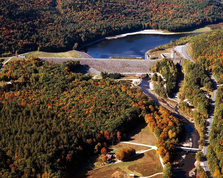
The earthen dam was constructed in 1961 by the United States Army Corps of Engineers with a height of 126 feet and a length of 1700 feet at its crest. It impounds Vermont's West River for flood control and seasonal storm water management. The dam is owned and operated by the Corps of Engineers. Its National ID number is VT00004.
The riverine reservoir it creates, Townshend Lake, has a normal water surface of 95 acres, a maximum storage capacity of 54,300 acre-feet, and a normal storage capacity of 800 acre-feet. Recreation includes fishing (for smallmouth bass, brown and rainbow trout), boating and hiking, along with facilities at the nearby Townshend State Park.
References
Townshend Dam Wikipedia(Text) CC BY-SA