FIPS code 08-78280 Elevation 1,802 m Zip code 81334 Area code 970 | Time zone Mountain (MST) (UTC-7) GNIS feature ID 0179166 Area 9 km² Population 1,087 (2010) | |
 | ||
Towaoc is a census-designated place (CDP) on the Ute Mountain Ute Tribe Reservation in Montezuma County, Colorado, United States. The population was 1,087 at the 2010 census. The Towaoc Post Office has the ZIP Code 81334.
Contents
Map of Towaoc, CO 81321, USA
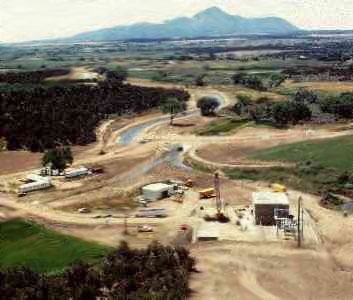
Towaoc is the capital of the Ute Mountain Ute Tribe, replacing a tribal headquarters and BIA sub-agency at Aztec Springs. It is located east of Sleeping Ute Mountain, a sacred mountain of the Ute people, northeast of the Four Corners Monument.
Geography
Towaoc is located at 37°12′20″N 108°43′37″W (37.205424, -108.727082).
According to the United States Census Bureau, the CDP has a total area of 3.5 square miles (9.1 km2), all land.
Old Towaoc, located at the base of Ute Mountain, is approximately 2 miles (3 km) west of US Highways 491-160, and includes various tribal and BIA governmental buildings and housing areas, including the tribal offices of the Ute Mountain Ute Tribe. In recent years, a small complex has been developed directly on US Highway 491-160 at the junction of the road into the original town. This includes the Ute Mountain Casino, Hotel & Resort, with a travel center (convenience store, food service, and fuel sales), campground, and the offices and shops for the Weeminuche Construction Authority (the Tribal construction company) and other facilities.
Demographics
As of the census of 2000, there were 1,069 people, 329 households, and 266 families residing in the CDP. The population density was 317.4 people per square mile (122.4/km²). There were 366 housing units at an average density of 105.9 per square mile (40.8/km²). The racial makeup of the CDP was 2.83% White, 0.09% African American, 94.44% Native American, 0.46% from other races, and 2.19% from two or more races. Hispanic or Latino of any race were 2.46% of the population.
There were 329 households out of which 52.6% had children under the age of 18 living with them, 43.2% were married couples living together, 32.2% had a female householder with no husband present, and 19.1% were non-families. 16.1% of all households were made up of individuals and 1.8% had someone living alone who was 65 years of age or older. The average household size was 3.30 and the average family size was 3.68.
In the CDP, the population was spread out with 40.9% under the age of 18, 9.7% from 18 to 24, 35.1% from 25 to 44, 10.8% from 45 to 64, and 3.6% who were 65 years of age or older. The median age was 25 years. For every 100 females there were 96.9 males. For every 100 females age 18 and over, there were 91.7 males.
The median income for a household in the CDP was $1,405, and the median income for a family was $1,796. Males had a median income of $1,583 versus $1,658 for females. The per capita income for the CDP was $531. About 9.0% of families and 2.3% of the population were below the poverty line, including 49.3% of those under age 18 and 27.3% of those age 65 or over.
