Harman Patil (Editor)

Tournehem sur la Hem

Updated on
Edit
Like
Comment
Share on FacebookTweet on TwitterShare on LinkedInShare on Reddit
Country
  
France

Department
  
Pas-de-Calais

Intercommunality
  
Pays de Saint-Omer

Area
  
18.14 km²

Arrondissement
  
Saint-Omer

Region
  
Hauts-de-France

Canton
  
Ardres

Population (2006)
  
1,253

Local time
  
Monday 11:05 PM

Tournehem-sur-la-Hem httpsuploadwikimediaorgwikipediacommonsthu

Weather
  
8°C, Wind SW at 6 km/h, 89% Humidity

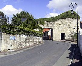
Tournehem-sur-la-Hem is a commune in the Pas-de-Calais department in the Hauts-de-France region of France.

Contents

Map of 62890 Tournehem-sur-la-Hem, France

Geography

Tournehem-sur-la-Hem is located 10 miles (16 km) northwest of Saint-Omer, at the D217 and D218 road junction, on the banks of the river Hem.

Places of interest

  • The church of Saint Médard, dating from the fifteenth century.
  • The ruins of the 12th-century château which was destroyed in 1542.
  • The tower of a 15th-century windmill.
  • The eighteenth-century château at Guémy.
  • The church of Notre-Dame at Guémy, dating from the eighteenth century.
  • The ruins of the 13th-century chapel of Saint Louis at Guémy.
  • References

    Tournehem-sur-la-Hem Wikipedia