
Elevation 3,009 m Mountain range Pyrenees | ||
 | ||
Parent range Massif du Mont-Perdu (Pyrenees) Similar Casque du Marboré, Pic de Marboré, Pic du Taillon, Cilindro de Marboré, Grand Astazou | ||
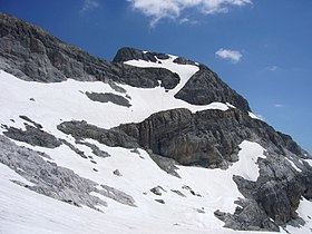
Tour du Marboré or Tour de Gavarnie is a pyrenean summit, culminating at 3,009 m (9,872 ft), located on the Franco-Spanish border crest in the Monte Perdido Range.
Contents
Map of Tour du Marbor%C3%A9, 22375, Huesca, Spain
Toponymy
see: Cilindro de Marboré
Topography
The Tour du Marboré is part of the range above Cirque de Gavarnie. It marks the border between the Pyrenees National Park of France and the Ordesa y Monte Perdido National Park of Spain.
Mountaineering
In 1956, it was climbed from the northern side by Jean Ravier and Claude Dufourmantelle.
References
Tour du Marboré Wikipedia(Text) CC BY-SA