
Time zone CET (UTC+1) Area 23.41 km² Population 297 (1999) | Canton Lignières INSEE/Postal code 18266 /18160 Local time Monday 7:44 PM | |
 | ||
Weather 16°C, Wind N at 8 km/h, 52% Humidity | ||
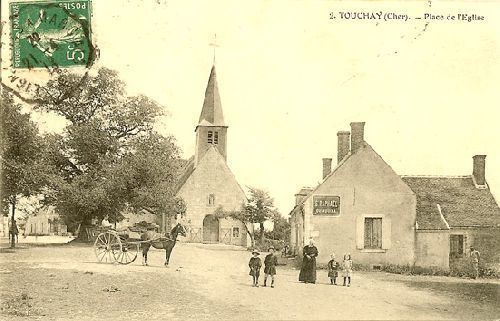
Touchay is a commune in the Cher department in the Centre region of France.
Contents
Map of 18160 Touchay, France
Geography
A farming area comprising the village and several hamlets situated on the banks of the river Arnon, about 23 miles (37 km) southwest of Bourges on the D69 road.
Sights
Personalities
References
Touchay Wikipedia(Text) CC BY-SA