
River mouth Garonne130 m (430 ft) Length 74 km | Basin size 515 km (199 sq mi) Basin area 515 km² | |
 | ||
Main source Plateau de Lannemezan350 m (1,150 ft) Discharge Average rate:3.92 m/s (138 cu ft/s) | ||
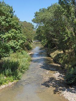
The Touch (French: le Touch, Occitan: Toish) is a 74.5 km (46.3 mi) long river in southwestern France, left tributary of the Garonne. Its source is in the département of Haute-Garonne, near Lilhac.
Map of Touch, France
It flows through the following départements and towns:
It flows into the river Garonne at Toulouse.
References
Touch (river) Wikipedia(Text) CC BY-SA