
 | ||
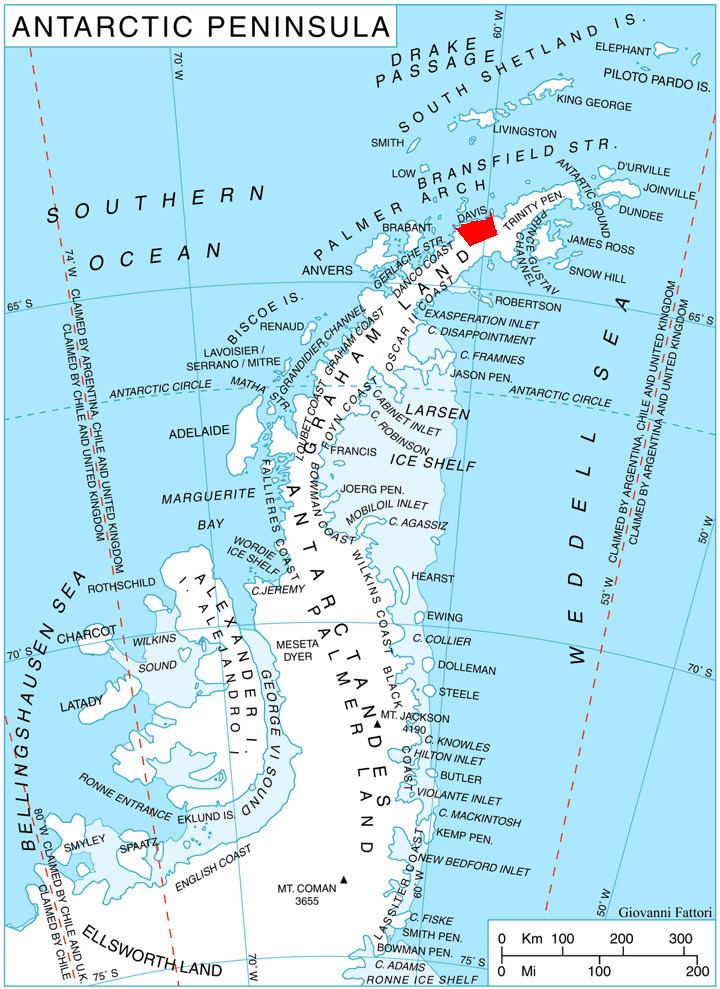
Topola Ridge (Bulgarian: хребет Топола, ‘Hrebet Topola’ \'hre-bet to-'po-la) is the 9 km long mostly ice-covered, narrow rocky ridge on Davis Coast in Graham Land, Antarctica, rising to 1500 m at its south extremity. It is situated on the northwest side of Detroit Plateau, abuts Zabernovo Bastion on the south, extending northwards to Matov Peak and ending in Hargrave Hill. The feature surmounts some tributaries to Wright Ice Piedmont to the southwest and Temple Glacier to the north and east.
Contents
The ridge is named after the settlement of Topola in Northeastern Bulgaria.
Location
Topola Ridge is centred at 64°02′25″S 60°07′00″W, which is 15.5 km south-southeast of Havilland Point. British mapping in 1978.
Maps
References
Topola Ridge Wikipedia(Text) CC BY-SA