
Length 41 km (25 mi) | Ring road around Toowoomba | |
 | ||
Type Highway (Under construction) Northeast end Warrego Highway (National Highway A2), Helidon Southwest end Gore Highway (National Highway A39 / State Route 85), Athol Major settlements Postmans Ridge, Queensland, Withcott | ||
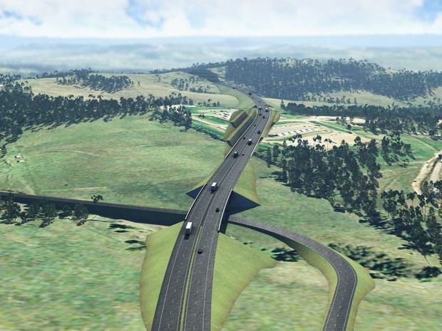
The Toowoomba Second Range Crossing (TSRC) is a bypass route that takes heavy vehicle traffic around Toowoomba rather than through it. The route, being delivered by the Department of Transport and Main Roads and Nexus Consortium will be 41 kilometres (25 mi) long and will pass Toowoomba on its northern side, linking the Warrego Highway at Helidon Spa in the east and the Gore Highway at Athol in the west (via Charlton).
Contents
The Australian and Queensland Governments are jointly funding the $1.6b project on an 80:20 basis. It is being delivered in a 25-year Public Private Partnership with the Nexus Infrastructure consortium.
Benefits
The Queensland Government claims the benefits include:
Route
The 41 kilometres (25 mi) route of the project is expected to include: 41 kilometres (25 mi) of bypass, a 30-metre cutting at the top of the Range (instead of the twin, 700 metre, three lane tunnels in the reference design), 24 Bridges, 6 interchanges, 9 Creek crossings and 1 viaduct.
The reference design, the basis for planning and environmental approval, features:
The planned maximum gradient is 6.5%
Construction
Nexus is a consortium of global leaders in road construction and public infrastructure, combined with Queensland-based resources with a successful track record of local project delivery. Nexus was awarded the contract to design, construct, operate and maintain the Toowoomba Second Range Crossing. The consortium consists of the following participants: Plenary Group, Cintra Infraestructuras Internacional S.L., Acciona Concesiones S.L., Acciona Infrastructure Australia, Ferrovial Agroman Australia and Broadspectrum.