
Country Poland Car plates LTM Capital Tomaszów Lubelski | Seat Tomaszów Lubelski Area 1,487 km² Voivodeship Lublin Voivodeship | |
 | ||
Gminas Total 13 (incl. 1 urban)
Tomaszów Lubelski
Gmina Bełżec
Gmina Jarczów
Gmina Krynice
Gmina Łaszczów
Gmina Lubycza Królewska
Gmina Rachanie
Gmina Susiec
Gmina Tarnawatka
Gmina Telatyn
Gmina Tomaszów Lubelski
Gmina Tyszowce
Gmina Ulhówek Points of interest Rezerwat przyrody Nad Tan, Rezerwat przyrody Czartowe, Muzeum – Miejsce Pamięci, Jeleń, Muzeum Skamieniałych Drzew | ||
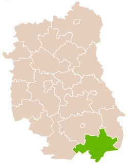
Tomaszów Lubelski County (Polish: powiat tomaszowski) is a unit of territorial administration and local government (powiat) in Lublin Voivodeship, eastern Poland, on the border with Ukraine. It was established on January 1, 1999, as a result of the Polish local government reforms passed in 1998. Its administrative seat and largest town is Tomaszów Lubelski, which lies 107 kilometres (66 mi) south-east of the regional capital Lublin. The only other towns in the county are Tyszowce, lying 28 km (17 mi) north-east of Tomaszów, and Łaszczów, lying 25 km (16 mi) east of Tomaszów.
Contents
Map of Tomasz%C3%B3w Lubelski County, Poland
The county covers an area of 1,487.1 square kilometres (574.2 sq mi). As of 2006, its total population was 88,343, including a population of 20,118 in Tomaszów Lubelski, 2,242 in Tyszowce, and a rural population of 65,983 (including approximately 2,300 for the population of Łaszczów, which became a town in 2010).
Neighbouring counties
Tomaszów Lubelski County is bordered by Lubaczów County to the south-west, Biłgoraj County to the west, Zamość County to the north and Hrubieszów County to the north-east. It also borders Ukraine to the south-east.
Administrative division
The county is subdivided into 13 gminas (one urban, two urban-rural and 10 rural). These are listed in the following table, in descending order of population.