Local time Sunday 11:55 AM | Population 2,149 (1 Jan 2009) | |
 | ||
Weather 12°C, Wind SW at 13 km/h, 81% Humidity | ||
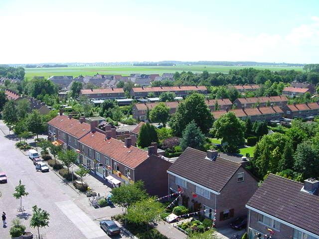
Tollebeek (52°41′N 5°41′E) is a village in the Dutch province of Flevoland. It is a part of the municipality of Noordoostpolder, and is approximately 90 kilometres north east of Amsterdam.
Contents
Map of Tollebeek, Netherlands
Tollebeek is one of ten villages in the Noordoostpolder (literally: North East Polder) which was reclaimed from the Zuiderzee (now: IJsselmeer) in the 1930s and 1940s as part of a huge project known as the 'Zuiderzeewerken' ('Zuiderzee works') to create new land to accommodate growing need for farmland and new urban areas in the already densely populated country.
After the Noordoostpolder was formed in the early 1940s, new villages were constructed, including Tollebeek. It is situated in the south-western part of the polder, in the middle of a large agricultural area, close to Urk which used to be an island in the old Zuiderzee.
Tollebeek's first houses were built in 1957.
As of October 2010, Tollebeek had 2,261 inhabitants, almost four times more than 25 years ago. Its growth can be attributed to the influx of people from nearby Urk, where homes are usually more expensive due to a shortage of available building plots.
Despite its relatively small size, Tollebeek has a thriving community culture, with several sports, arts and youth clubs. There are two churches (Roman Catholic and Protestant), three primary schools, a restaurant, two fast food bars and a small supermarket.
Transportation
The nearest railway stations to Tollebeek are in Lelystad and Kampen, both approximately 30km from Tollebeek. There is a bus service running from nearby Emmeloord and Urk. The village can be reached by car via the A6 motorway from Almere and Lelystad.
