Time zone NZST (UTC+12) Area code 06 | Local time Sunday 8:46 PM | |
 | ||
Weather 21°C, Wind W at 16 km/h, 71% Humidity | ||
Meet this week s winning wheel winner clive from tolaga bay
Tolaga Bay (Māori: Uawa) is both a bay and small town on the East Coast of New Zealand's North Island located 45 kilometres northeast of Gisborne and 30 kilometres south of Tokomaru Bay.
Contents
Map of Tolaga Bay, New Zealand
It was named Tolaga Bay by Lt. James Cook, In 1769, but the original Māori name is Uawa Nui A Ruamatua (shortened to Uawa), and some local residents now refer to the area as Hauiti, and themselves as Hauitians from the local iwi Te Aitanga-a-Hauiti.
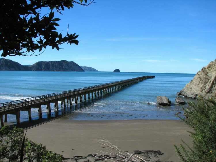
The region around the bay is rugged and remote, and for many years the only access to the town was by boat. Because the bay is shallow, a long wharf - the longest in New Zealand (600m) - was built in the 1920s to accommodate visiting vessels. The last cargo ship to use the wharf loaded a cargo of maize in 1967. In the 1830s there was a thriving flax trade involving early European traders like Barnet Burns. By 1998, the wharf had deteriorated and was in danger of being closed. In response, the Tolaga Bay Save the Wharf Trust raised funds and gained technical help to restore it. The wharf has now been re-opened and the refurbishment project should finish by May 2013.
The Uawa River reaches the Pacific Ocean in the middle of Tolaga Bay. There is a bar at the river mouth with around 2 metres of water at high tide. The Uawa River is called the Hikuwai further up. Tributaries include the Waiau and the Mangaheia.
An island in the bay was originally named Spöring Island by Cook, after his expedition's assistant naturalist and instrument maker, Herman Spöring, a Finnish botanist. It is however today again known by its Māori name, Pourewa.
The town is a popular holiday spot. Its population is predominantly Māori, a centre of the Te Aitanga-a-Hauiti iwi and home of Ariki - Te Kani a Takirau and Tohunga - Rangiuia.
