
Population 110,000 Area 16,128 km² | ||
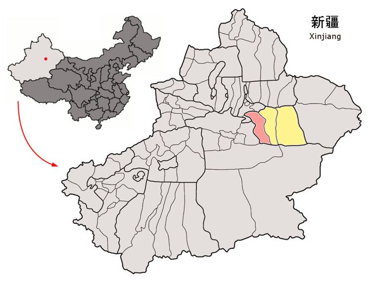 | ||
Toksun (Toqsun) County (Uyghur: پىتوقسۇن ناھىيىسى, Тоқсун Наһийиси, ULY: Toqsun Nahiyisi, UYY: Tok̡sun Nah̡iyisi?) is a county within the Xinjiang Uyghur Autonomous Region of the China (PRC) and is under the administration of the Turpan Prefecture. It contains an area of 16,128 km2 (6,227 sq mi). According to the 2002 census, it then had a population of 110,000. Its location in the bottom of the Turfan Pendi and an average rainfall of just 25 mm annually make it a very hot place during summertime. On July 31, 1964, the highest recorded temperature was 53.3 °C (127.9 °F), which is the highest reliable temperature, recorded during standard conditions anywhere in China.
Contents
Map of Toksun, Turpan, Xinjiang, China
History
The Battle of Toksun took place in this county in July 1933 when Khoja Niyas Hajji, a Uighur leader, defected with his forces to Governor Sheng Shicai. He advanced to Toksun via Dawan Ch'eng, where the Chinese Muslim forces of General Ma Shih-ming achieved victory over Niyas Hajji's forces.
Reportedly enslaved mentally disabled people worked at the Jiaersi Green Construction Material Chemical Factory.
(source:http://www.chinadaily.com.cn/china/2010-12/14/content_11701899.htm)