
- elevation 4,195 ft (1,279 m) | - elevation 377 ft (115 m) | |
 | ||
- location 50 miles (80 km) east of Bitzshtini Mountains, Yukon–Koyukuk Census Area | ||
Alaska trip denali national park bus tour of poly chrome mountains toklat river
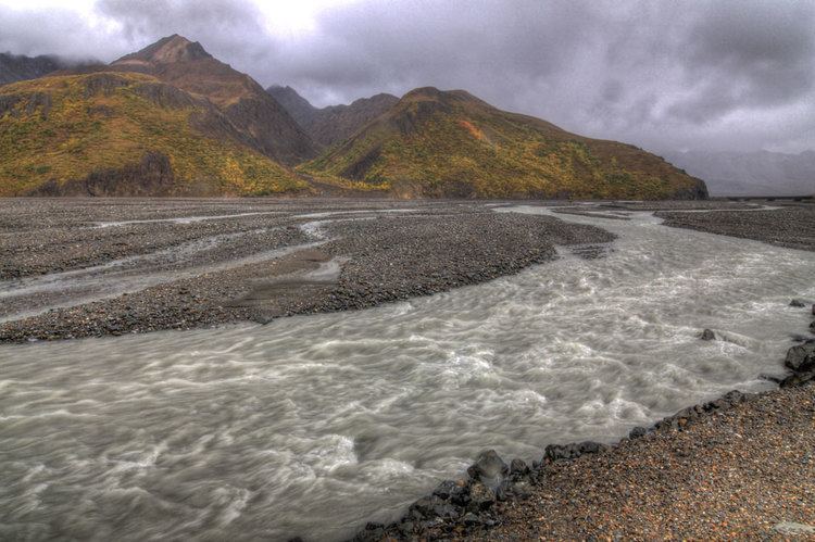
The Toklat River (Lower Tanana: Tootl'o Huno') is an 85-mile (137 km) tributary of the Kantishna River in central Alaska in the United States It drains an area on the north slope of the Alaska Range on the south edge of the Tanana Valley southwest of Fairbanks. It issues from unnamed glaciers in the northern Alaska Range in Denali National Park and Preserve, northeast of Denali. It flows generally northwest through hilly country to the tundra to the north of the Alaska Range.
Contents
- Alaska trip denali national park bus tour of poly chrome mountains toklat river
- Map of Toklat River Alaska USA
- Denali toklat river view alaska
- References
Map of Toklat River, Alaska, USA
The river was described as the Toclat by Lt. H.T. Allen in 1885. Other names or variants include Tootl'ot Huno, Tootl'ot Huno' Hutl'ot, Tootl'ot No' and Tutlut River. Depth of 50 ft, width of 25 ft
Denali toklat river view alaska
References
Toklat River Wikipedia(Text) CC BY-SA