
Country Japan - Tree Japanese stuartia Phone number 0282-21-2224 Prefecture Tochigi Prefecture | Region Kantō - Flower Japanese azalea Population 159,648 (Dec 2015) | |
 | ||
Time zone Japan Standard Time (UTC+9) Weather 11°C, Wind SE at 14 km/h, 53% Humidity Points of interest Ōhirasan Shrine, Mikamoyama Park, Tochigikuranomachi Museum, Iwashitanoshinshoga Museum, Mt Taihei | ||
Tochigi (栃木市, Tochigi-shi, [tóꜜchìgì]) is a city located in Tochigi Prefecture, in the northern Kantō region of Japan. As of May 2015, the city had an estimated population of 159,648 and a population density of 482 persons per km². Its total area was 331.50 square kilometres (127.99 sq mi). Because the city escaped war damage during World War II, many historical temples, traditional shops and kura (Japanese traditional storehouses) remain in the city center. The city was awarded the "Utsukushii-machinami Taisho" prize from the Ministry of Land, Infrastructure, Transport and Tourism in 2009.
Contents
- Map of Tochigi Tochigi Prefecture Japan
- Geography
- Surrounding municipalities
- History
- Economy
- Education
- Railway
- Highway
- Local attractions
- Noted people from Tochigi
- References
Map of Tochigi, Tochigi Prefecture, Japan
Geography
Tochigi is located in the very southern portion of Tochigi Prefecture, bordering on Ibaraki Prefecture and Gunma Prefecture to the southwest. In the southern part of the city the Yanaka Reservoir, which is in the Watarase flood control area, is used for sailboating and windsurfing. It was designated a Ramsar Site in June 2012.
Surrounding municipalities
History
In the Edo period Tochigi prospered from its location on the Uzumagawa River, which connected with the Tone River to Edo. Envoys using the Reiheishi Way sent from the Imperial Court going to Shrines and Temples of Nikkō stayed at the lodging area in the city. Most the area was formerly tenryō territory controlled directly by the Tokugawa shogunate; however, the minor feudal domain of Fukiake Domain was located within the borders of modern city of Tochigi.
Following the Meiji Restoration and the creation of Tochigi Prefecture, Tochigi Town was the prefectural capital from 1871 until its relocation to Utsunomiya in 1884. On April 1, 1937, Tochigi was elevated to city status.
On September 30, 1954, Tochigi absorbed the villages of Ōmiya, Minagawa, Fukiage and Terao (all from Shimotsuga District). This was followed by the village of Kōō (from Shimotsuga District) on March 31, 1957. Tochigi hosted its first film festival, the Kuranomachikado, or, "Eizo Film Festival" from October 5, 2007, to October 8, 2007. On March 29, 2010, Tochigi absorbed the towns of Fujioka, Ōhira and Tsuga (Shimotsuga District). This was followed by the town of Nishikata (from Kamitsuga District) on October 1, 2011, and the town of Iwafune (from Shimotsuga District) on April 5, 2014.
Economy
Tochigi city is a regional commercial center, and has a mixed local economy. Food processing, automotive parts and light manufacturing dominated the industrial sector. Isuzu has maintained a factory since 1961. In 2010, the city ranked first in the number of farming families in the prefecture.
Education
Railway
Highway
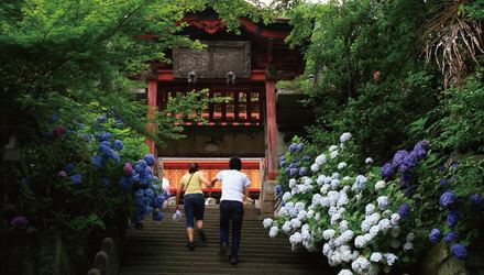
Local attractions
*the sound of Tree frogs in Ajisai-zaka, Mount Ohirasan in Tochigi have been designated as one of the 100 Soundscapes of Japan by the Ministry of the Environment