
Country Algeria District Tizi Ouzou District | Area 102.36 km2 | |
Colleges and Universities Mouloud Mammeri University of Tizi-Ouzou, Institut dArchitecture de Tizi-Ouzou | ||
Tizi Ouzou (Berber: Tizi Wezzu, ???? ?????, Algerian Arabic: ???? ???) is a city in north central Algeria. It is the capital and largest city of Tizi Ouzou Province. It is the second most populous city in the Kabylie region behind Bejaia.
Contents
Map of Tizi Ouzou
Attentat terroriste a iboudrarene tizi ouzou algerie
History
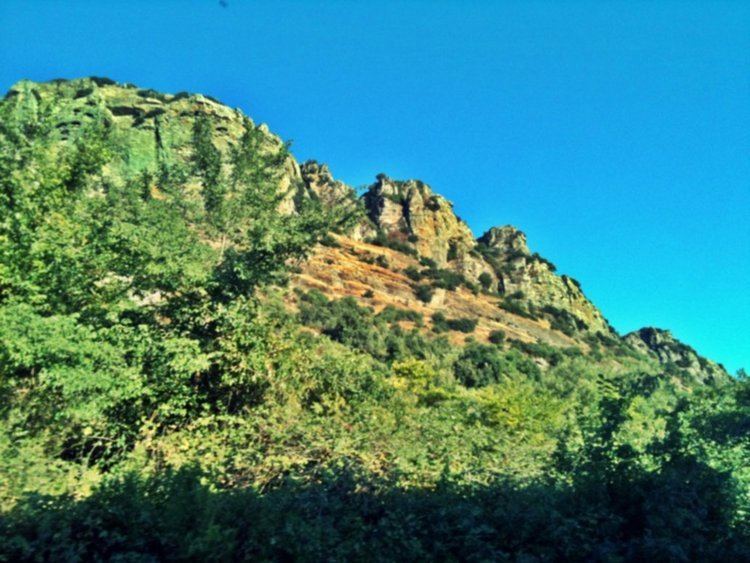
The name comes from the Berber language Tizi n Uzzu and is pronounced Tizuzzu, commonly Tizi which means the "hill", while Azzu means the "shrub" (the preposition n "of" is not pronounced here). That is why the city is often referred to as "The hills of shrubs".
Geography
The city in north central[Algeria. It is the capital and largest city of Tizi Ouzou Province.
This city is located in the heart of Kabylie. It is 102.36 square kilometres (39.52 sq mi) in area. Tizi Ouzou is located in the valley of Wadi Sebaou. It is surrounded by mountains. The city is at an altitude of 200 metres (660 ft). The city is bounded on the north by Mount Belloua which rises to 850 metres (2,790 ft) above sea level. A portion of the old city of Tizi Ouzou (known as the High City) backed the east slopes of the mountain. At the top of the mountain Belloua lies the village of Redjaouna. The latter is attached to the town of Tizi Ouzou.