
Time zone +5.30 Area 2,180 km² Local time Sunday 12:40 AM | Elevation 19 m | |
 | ||
Weather 27°C, Wind NW at 3 km/h, 87% Humidity Points of interest Tissamaharama Raja Maha Vihara, Flamingos Safari Tours, Yatala Vehera, Galkanumandiya Ruins | ||
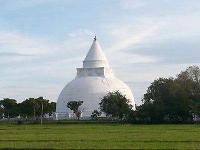
Tissamaharama (Sinhala තිස්සමහාරාමය [ˈtissəmaˌhaːˈraːməyə], Tamil திஸ்ஸமஹாராம) is a town in Hambantota District, Southern Province, Sri Lanka.
Contents
Map of Tissamaharama, Sri Lanka
History
It used to be the capital of the Sinhalese Kingdom of Ruhuna as early as the 3rd century B.C. Only few buildings from that period can still be seen today. The presence ordinary early Tamils in Tissamaharama was confirmed following archaeological excavations in 2010. The Tissamaharama Tamil Brahmi inscription, a fragment of black and red ware flat dish inscribed in Tamil in the Tamil Brahmi script was excavated at the earliest layer in the southern town.
The large artificial Tissa Wewa lake, which was a part of a sophisticated irrigation system, also dates from that time.There are five main lakes in the vicinity of Tissamaharama: Tissa Wewa; Yoda Wewa; Weerawila Wewa; Pannegamuwa Wewa; and Debarawewa Wewa.
Today, the town mainly serves as a starting point for visits to Yala National Park and Kataragama.