
Nearest city Winamac, Indiana Operated by Indiana DNR Area 11.17 km² | Created 1943 (1943) Website DNR page Phone +1 574-946-3213 | |
 | ||
Location Pulaski County, Indiana, United States Address 4200 Base Rd N, Winamac, IN 46996, USA Similar Riverside Rentals, Broken Arrow Campgro, Bass Lake Beach & Campgro, Rising Sun Campgro, Yogi Bear's Jellystone Park | ||
Tippecanoe river state park indiana dnr
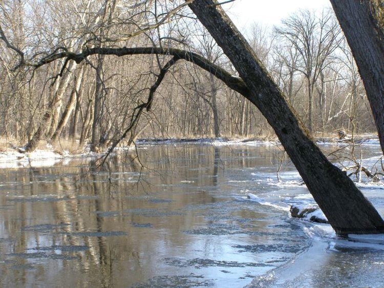
Tippecanoe River is a state park in Pulaski County, Indiana, United States. It is located 58 miles (93 km) south-southwest of South Bend, Indiana. Noted for a grove of old-growth white pine trees, the park also preserves more than 2 miles (3 km) of undisturbed wetland shoreline on the Tippecanoe River. It was formed when in 1943 the National Park Service gave to Indiana's Department of Conservation land to form a state park, with other land along the river becoming the Winamac Fish and Wildlife Area.
Contents
- Tippecanoe river state park indiana dnr
- Tippecanoe river solo canoe trips tippecanoe river state park winamac indiana
- The riverEdit
- Enjoying the parkEdit
- Protected areasEdit
- References
During the Great Depression of the 1930s, the national government established the Recreational Demonstration Area in the Department of the Interior, National Park Service. The Park Service located low quality farmlands with high quality park potential. Along the Tippecanoe River, the Federal Government purchased 7,353 acres (2,976 ha). The high sand content of the soil made this poor quality farm lands. The river way and forest made it quality parklands. Development of the Demonstration Area was undertaken by the Works Progress Administration. In 1943, the property was transferred to the State of Indiana's Department of Conservation as a state park. On January 1, 1959, 4,592 acres (1,858 ha) were transferred to the Division of Fish and Wildlife as the Winamac Fish and Wildlife Area. The state park retains 2,761 acres (1,117 ha) of the original development.
Tippecanoe river solo canoe trips tippecanoe river state park winamac indiana
The riverEdit
Canoeing is very popular in the park, as the Tippecanoe River stretches seven miles (11 km) along the park's borders. A canoe-exclusive campsite has ten sites. It is also a river otter release area. Bluegill and bass are commonly fished from the river. The river is too dangerous for swimming, so those camping in the park can go to the Bass Lake State Beach five miles (8 km) away.
Enjoying the parkEdit
There are ten miles (16 km) of hiking trails and thirteen miles (20 km) of horseback trails. Cultural arts programs, and a seasonal naturalist is also available. Most visitors drive to the park, although pilots can land at the nearby Arens Airport and have a courtesy car take them to the park.
Things to do
- Family camping
- Potawatomi Group Camp
- Youth Tenting
- Rent-A-camp cabin
- Canoe camping from the river