
Basin countries United States Surface elevation 984 m Area 5.6 km² | Average depth 45 feet (14 m) Max depth 24 m Mean depth 14 m | |
 | ||
Surface area 2.17 square miles (5.6 km) Location Clackamas County, Oregon, United States | ||
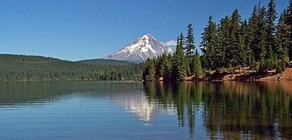
Timothy lake oregon canoe camping and fishing
Timothy Lake is a lake about 50 miles (80 km) southeast of Portland, Oregon, United States. It is in proximity to Clear Lake and an impoundment of the Oak Grove Fork Clackamas River.
Contents
- Timothy lake oregon canoe camping and fishing
- Map of Timothy Lake Oregon USA
- Hoodview campground timothy lake mt hood oregon 12
- References
Map of Timothy Lake, Oregon, USA
The compacted-earth Timothy Lake Dam was built by Portland General Electric in 1956 to regulate seasonal water flow to Lake Harriet downstream. The dam, 110 feet high and impounding 81,000 acre-feet, does not generate any hydroelectric power itself. In the summer, the lake is a very popular destination for camping, boating, hiking, horseback riding, and mountain biking.
Hoodview campground timothy lake mt hood oregon 12
References
Timothy Lake Wikipedia(Text) CC BY-SA