Coat of arms Flag Federal subject Krasnodar Krai Town Timashyovsk Local time Saturday 5:06 AM | Country Russia Administrative district Timashyovsky District Area 30 km² | |
 | ||
Administrative center of Timashyovsky District, Town of Timashyovsk Weather -2°C, Wind NE at 8 km/h, 76% Humidity | ||
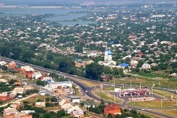
Timashyovsk (Russian: Тимашёвск) is a town and the administrative center of Timashyovsky District of Krasnodar Krai, Russia, located on the Kirpili River 73 kilometers (45 mi) north of Krasnodar, the administrative center of the krai. As of the 2010 Census, its population was 53,924.
Contents
- Map of Timashevsk Krasnodarskiy Kray Russia
- History
- Administrative and municipal status
- Twin towns and sister cities
- References
Map of Timashevsk, Krasnodarskiy Kray, Russia
History
It was founded in 1794 and was granted town status in 1966. On August 17, 1942, 21 Jews were shot in the sovkhoze “Timachevets”. Seven other Jews were arrested in the hamlet Proletary and taken to there in order to be killed. According to the Extraordinary Soviet Commission, 75 Jews were shot in August 1942 in this location by an Einsatzgruppen.
Administrative and municipal status
Within the framework of administrative divisions, Timashyovsk serves as the administrative center of Timashyovsky District. As an administrative division, it is, together with one rural locality (the settlement of Kirpichny), incorporated within Timashyovsky District as the Town of Timashyovsk. As a municipal division, the Town of Timashyovsk is incorporated within Timashyovsky Municipal District as Timashyovskoye Urban Settlement.
Twin towns and sister cities
Timashevsk is twinned with:
