
Population 433 (2006 census) Local time Saturday 2:45 AM | Postcode(s) 4650 Postal code 4650 | |
 | ||
LGA(s) Fraser Coast Regional Council Weather 21°C, Wind S at 10 km/h, 81% Humidity | ||
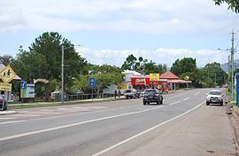
Tiaro /ˈtaɪroʊ/ is a small town on the Mary River in Queensland, Australia. The town is situated on the Bruce Highway 27 kilometres (17 mi) south of Maryborough and 227 kilometres (141 mi) north of the state capital, Brisbane. At the 2006 census, Tiaro had a population of 433.
Contents
Map of Tiaro QLD 4650, Australia
Timber and farming are the predominant industries in the Tiaro area, although the town's position on Queensland's main coastal highway also brings economic benefits.
History
The Tiaro War Memorial commemorates those who served in World War I. It was unveiled on 25 April 1921 (ANZAC Day) by Sir Thomas William Glasgow.
Originally the main centre of the Shire of Tiaro, Tiaro became part of the Fraser Coast Regional Council after the amalgamations of local councils on 17 March 2008.