
Country England | Status Parish | |
 | ||
Primary council East Riding of Yorkshire Region Yorkshire and the Humber Weather 17°C, Wind SW at 34 km/h, 54% Humidity | ||
Thwing and Octon (also known as Thwing) is a civil parish in the northern Yorkshire Wolds in the East Riding of Yorkshire, England.
Contents
Description
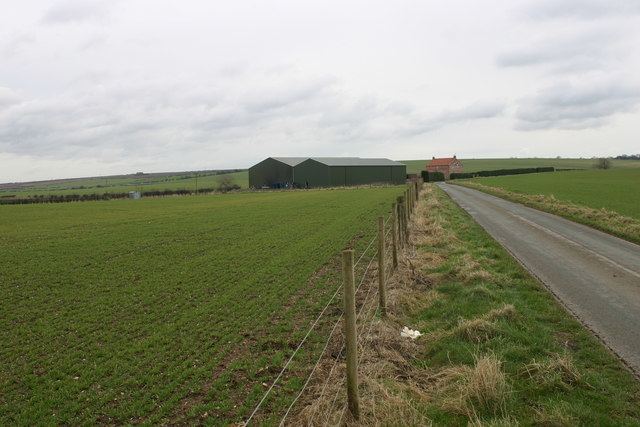
Thwing and Octon is about 8 miles (13 km) north of the town of Driffield, and a similar distance west of Bridlington on the Yorkshire coast. It rises from about 45 m (148 ft) in the north-east corner of the parish to a high point of 163 metres (535 ft) in the south-west. The parish covers an area of 1,628.644 hectares (4,024.47 acres).
The civil parish is sparsely populated, with, according to the 2011 UK census, a population of 203, the same as the 2001 UK census figure. The main settlements are the village of Thwing and the smaller hamlet of Octon. There are farmsteads at Octon Grange, The Wold Cottage, and Willy Howe farm. Land use is almost entirely agricultural, predominately enclosed fields. There is a private crematorium, East Riding Crematorium, at Octon Crossroads, built in 1997.
History and archaeology
See also histories of Thwing, and OctonThere is evidence of significant human activity in the area beginning in at least the Neolithic Era: at Paddock Hill 0.6 miles (1 km) north of Octon, evidence of a henge dating from the late Neolithic has been discovered from crop marks and by excavation. The same site also shows evidence of re-use and modification into a hill fort during the Bronze Age, including artefacts typical of the Urnfield culture, and evidence of bronze metalworking. The site was re-used during the Anglo-Saxon period and contained houses including a grubenhaus and large rectangular hall; there was a cemetery with at least 130 inhumations east of the Bronze Age earthwork. During the 1200s a post mill was constructed.
Two tumuli have been recorded and excavated in the northern part of the parish: the large mound named 'Willy Howe'; and another barrow, about 0.5 mi (0.8 km) to its west, in fields south of the village of Wold Newton.
There are several other structures identified as barrows in the parish. Other evidence of pre-historic settlement and activity include polished stone axes and flint implements including arrowheads, chisels and knives, as well as flint cores, tranchet axes and microliths; pebble maceheads; and bronze or Iron Age pottery. A late Bronze Age (c. 1150 to 750 BC) penannular ring of pale and yellow gold applied on a base metal core was found by metal detection in 2004 near Thwing.
Finds of Roman pottery, including Samian ware, provide evidence of occupation during the Roman era, and a potential Romano-British settlement has been located about 0.6 miles (1 km) north-east of Thwing, with nearby rectilinear enclosures and trackways dating from the Iron Age or Roman period.
A monastic grange associated with Meaux Abbey was recorded at Octon Grange, north of Octon, in the 12th century.
The Wold Cottage meteorite fell in the parish in 1795, and is commemorated by a monument.
In 1812 the parish's population was recorded as 268 persons in 37 houses; the predominant occupation was farming. According to Sheahan, in the 1850s the parish had a total population of 599, and an area of 4,060 acres (1,640 ha), the population had risen by a factor of two in the first half of the 19th century. It fell during the last decades of the 19th century and the first half of the 20th century: by 1951 it was below the 1811 population level. By the 1961 census the population had been reduced to 244.