
Country Thailand Time zone THA (UTC+7) Area 452.3 km² Province Satun Province | Seat Thung Wa Postal code 91120 Population 20,683 (2005) Geocode 9106 | |
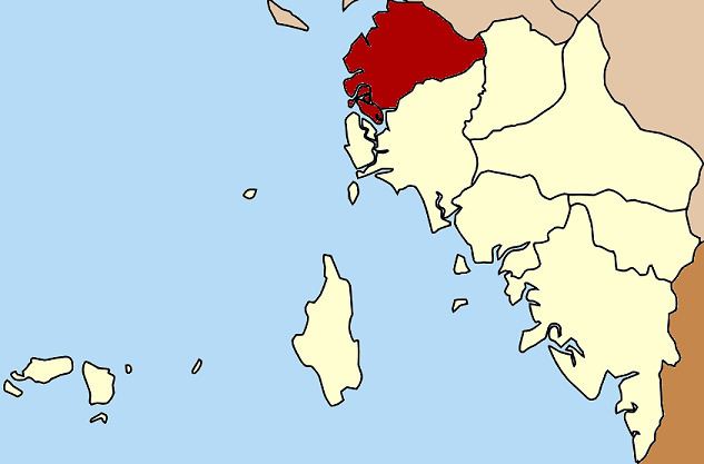 | ||
Thung Wa (Thai: ทุ่งหว้า) is a district (Amphoe) of Satun Province, southern Thailand.
Contents
Map of Thung Wa District, Satun, Thailand
History
Thung Wa was one of the three original districts of Satun. The main industry at the beginning of the 20th century was pepper production. When the production declined in the 1910s, many natives moved to the farmland of La-ngu minor district, while foreign merchants left the area completely. In 1930 the government adjusted the administrative structure to the changed economic situation, making La-ngu a district and reducing Thung Wa to a minor district (King Amphoe) under La-ngu. In 1973 Thung Wa regained district status.
Geography
Neighboring districts are (from the north clockwise) Palian of Trang Province. Manang and La-ngu of Satun Province. To the west is the Andaman Sea.
A big part of the shoreline of the district as well as several islands are part of the Mu Ko Phetra National Park.
Administration
The district is subdivided into 5 subdistricts (tambon), which are further subdivided into 35 villages (muban). Thung Wa is a township (thesaban tambon) which covers parts of tambon Thung Wa. There are further 5 Tambon administrative organizations (TAO).