
Population 9,938 Sovereign state United Kingdom | Post town SUNDERLAND | |
 | ||
Thorney close
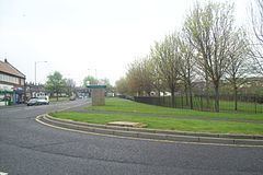
Thorney Close is a suburb of Sunderland, Tyne and Wear in England.
Contents
Map of Thorney Close, Sunderland, UK
It is located on the northern edge of the A690 (Durham Road), and borders with Grindon to the north and Herrington to the south, and the A19 to the west.
Work began on the council estate in 1947 and the first 77 houses were completed in 1948. In 1971 the population had risen to just under 14,000. According to the 2001 Census, the population was 9,938, with 36.7% living in council houses.
The estate has three shopping arcades, a community centre, two public houses, a recently built residential home for the elderly, three Methodist churches, and two primary schools, and a secondary school which was rebuilt in 2003. The former secondary school site is host to the new school, community centre, the local branch library, which was moved from Grindon and a walk in health centre.
Most of the streets in Thorney Close begin with the letter "T". Such as, Telford Road, Thames Road, Thorney Close Road, Taunton Square, Tadcaster Road.
Deprivation
According to the Indices of Deprivation published by the Department of the Environment, Transport and the Regions in 2000, Thorney Close ranks worst of all twenty-five wards in Sunderland for Income, Employment (55th most deprived ward in England), and Child Poverty (147th most deprived ward in England). It is second most deprived ward in Sunderland overall, behind Southwick However locals do rank Pennywell, Hendon, Witherwack, Carley Hill, Redhouse etc. as areas of worse deprivation.