
Demonym(s) Tholenaar Postcode 4675, 4690–4699 Area 254.4 km² Local time Thursday 8:14 PM | Elevation -1 m (−3 ft) Time zone CET (UTC+1) Area code 0166, 0167 | |
 | ||
Weather 18°C, Wind S at 13 km/h, 54% Humidity | ||
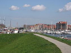
Motorhome camperstop in tholen zeeland the netherlands
Tholen ( pronunciation ) is a 25,000 people municipality in the southwest of the Netherlands. The municipality of Tholen takes its name from the town of Tholen, which is the largest population center in the municipality.
Contents
- Motorhome camperstop in tholen zeeland the netherlands
- Map of Tholen Netherlands
- Population centers
- Twin towns
- References
Map of Tholen, Netherlands
The municipality consists of two peninsulas, formerly islands, the larger one on the south also called Tholen, the smaller one on the north called Sint Philipsland. The two are separated by the former strait, now bay, of Krabbenkreek. The municipality is bordered on the east by the Eendracht, once a Scheldt branch but now part of the Scheldt-Rhine Canal, crossed by three road bridges, by the Oosterschelde estuary to the south, the straits of Keeten-Mastgat to the west and the Krammer strait to the north.
The town has a small historical center partly surrounded by a "gracht" and partly bordered by a harbour for fishing boats and yachts.
Population centers
On the island Sint Philipsland there are three villages:
On the island Tholen there are seven population centers: