
PIN 629177 Local time Thursday 7:47 PM | Time zone IST (UTC+5:30) Telephone code 04651 | |
 | ||
Weather 30°C, Wind W at 10 km/h, 75% Humidity | ||
Thiruvattar a.k.a. Thiruvattaru' is a panchayat town in Kanniyakumari district in the Indian state of Tamil Nadu.
Contents
Map of Thiruvattaru, Tamil Nadu 629177
About the town
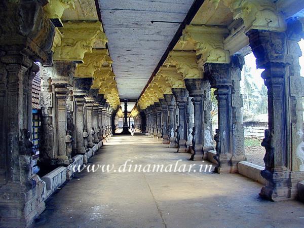
This town is situated 6 km north-east of Marthandam and 30 km north-west of Nagercoil. The two main rivers Pahrali River and Kothai surround the village and join in Moovattumugam, giving the name Thiru (sacred)+ vatta (surround)+ aru (river). This village, where the Sri Adikesavaperumal Temple is located, is one of the 108 Divya Desams.
Demographics
As of 2001 India census, Thiruvattaru had a population of 18,404. Males constitute 49% of the population and females 51%. Thiruvattaru has an average literacy rate of 77%, higher than the national average of 59.5%: male literacy is 78%, and female literacy is 75%. In Thiruvattaru, 10% of the population is under 6 years of age.
Politics
Thiruvattar assembly constituency is part of Nagercoil (Lok Sabha constituency).
As per the latest restructuring, the Thiruvattar assembly constituency has been split and merged with nearby constituencies.